Sarajevo's neighbourhoods: where to base yourself and where to go
What are Sarajevo's main neighbourhoods and how do they differ?
Sarajevo runs along one narrow valley: Baščaršija and the centre for sightseeing and eating, Bistrik at the foot of the Trebević cable car, and Ilidža at the western end, near the airport, with the walk out to Vrelo Bosne. The city also crosses a real administrative line — Istočno Sarajevo, part of Republika Srpska, sits just east of the centre with its own bus station and Cyrillic signage.
One valley, several different cities
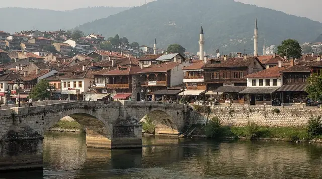
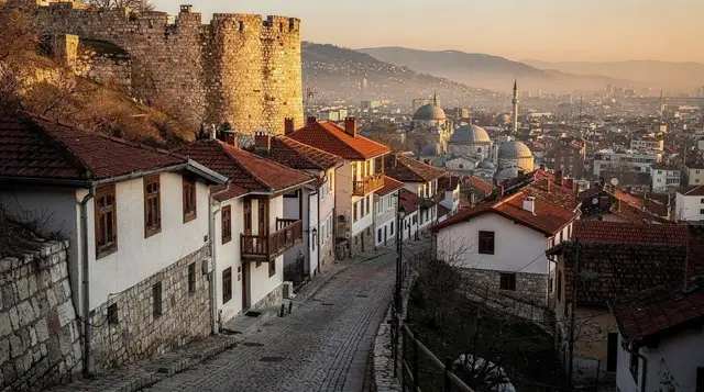
Sarajevo is not really one place. It is a string of neighbourhoods threaded along the narrow Miljacka valley, each one shaped by a different empire, a different decade or a different side of a war, and each one still legible today if you know where to look.
Ottoman Baščaršija gives way, walking west, to the Austro-Hungarian grid around Ferhadija; the socialist-era boulevard once nicknamed Sniper Alley runs on from there; and the valley finally opens out at Ilidža, twelve kilometres from the centre, near the airport. Climb instead of walking west, and the hillsides rise steeply on three sides — Bistrik, then the ridge of Trebević, the setting for the 1984 Winter Olympics and, before that, for the siege.
None of this is a museum layout. People live in all of it, and the boundaries between neighbourhoods matter for ordinary reasons: which tram to take, which market is nearest, which side of the city has cheaper rent. One boundary matters more than the rest, because it is not just a neighbourhood line but an entity line — the point, barely marked to a passer-by, where the Federation of Bosnia and Herzegovina ends and Republika Srpska begins.
This guide works through the city’s real geography for anyone deciding where to base themselves, or where a spare afternoon is best spent, rather than retracing a single signature street. For that kind of close, block-by-block walk, see the Baščaršija walking guide or the Ferhadija Austro-Hungarian walk instead.
Baščaršija and the centre: the obvious base, for good reason
Most stays are built around Baščaršija and the blocks immediately west of it, and that is the right call for one to three nights. The Sebilj fountain and the old bazaar sit within ten minutes of the Gazi Husrev-bey mosque, the Latin Bridge and the cluster of faiths that gives Sarajevo its old nickname of a small Jerusalem — an Orthodox church, a Catholic cathedral and a synagogue within the same quarter hour of walking as the mosque.
Ferhadija, the pedestrian street that continues the line west, marks the visible seam where Ottoman low-rise gives way to Austro-Hungarian facades; locals sometimes point to a strip of paving in the street itself as the exact join.
The trade-off is noise and tourist pricing in the streets directly on Baščaršija’s main square, worst around the Sebilj at midday in July and August. Quieter, still-central options sit one or two streets back, uphill towards Alifakovac or the old Jewish quarter, and cost less. For a fuller comparison of areas and price bands, see where to stay in Sarajevo.
Bistrik: the quiet slope with the cable car
Immediately southeast of Baščaršija, the ground tips upward into Bistrik — a residential hillside neighbourhood whose one clear reason to visit is transport, not sightseeing. The lower station of the Trebević cable car sits here, reopened in 2018 after a 26-year gap and covering the roughly nine-minute ride up to 1,164 metres for around 20 KM return.
Most visitors treat Bistrik as a ten-to-fifteen-minute walk uphill from Baščaršija rather than a base: it has far fewer restaurants and shops, and evenings are genuinely quiet. It is worth choosing deliberately if a view over the rooftops each morning matters more than being steps from dinner. Details on timing, tickets and what the ride actually shows are in the cable car guide.
Trebević: above the city, above the siege lines
The ridge above Bistrik was, for most of the siege, a Bosnian Serb artillery position looking straight down onto the city; today it is a hiking and picnic hillside with one striking relic, the abandoned 1984 Olympic bobsleigh track, now covered in graffiti and freely walkable. The contrast — a wartime gun position that is also an Olympic venue that is also, now, a piece of open-air street art — is the whole point of going up, and it rewards more time than the cable car alone allows.
Trails continue along the ridge for those who want a longer walk; the Trebević hiking guide and the dedicated bobsleigh track guide cover routes and practicalities. As with any hillside walking around Sarajevo, keep to marked paths and maintained trails — mined ground remains a real risk in parts of the wider countryside, even where a slope looks unremarkable.
a guided highlands hike with lunch included covers Trebević’s ridge with a local guide who knows exactly where the marked paths run, which removes any guesswork.
Ilidža and the walk to Vrelo Bosne
At the western end of the valley, roughly twelve kilometres and twenty-five minutes by tram from the centre, Ilidža is a different register of neighbourhood again: spa-town streets, older hotels, and the green approach to the source of the Bosna river.
From the Ilidža tram terminus, the Velika aleja — a 3.5-kilometre avenue of plane trees planted under Austro-Hungarian rule — is walked, cycled or ridden by horse-drawn fiacre out to Vrelo Bosne itself, where the river surfaces from the ground in a scatter of small pools and channels. It is an easy half-day out, close enough to combine with the airport on a departure day, and the full route and options are in the Vrelo Bosne visiting guide.
Ilidža is close to Sarajevo International Airport (SJJ) as well — the two sit only a few kilometres apart — which makes the neighbourhood a reasonable last-night base for an early flight, at the cost of a longer tram or taxi ride into Baščaršija for every evening out.
Where the Federation quietly ends
The one border inside Sarajevo that is not really about geography at all runs east of the centre, at Istočno Sarajevo — East Sarajevo — which includes the Lukavica district. Cross it and the signage shifts from the Latin alphabet to Cyrillic, flags and vehicle number plates change style, and administratively you have left the Federation of Bosnia and Herzegovina for Republika Srpska, one of the country’s two entities alongside the smaller Brčko District. Nothing is checked or stamped; a tram or a taxi crosses it exactly as it crosses any other neighbourhood line. It is worth knowing about mainly because it explains something visitors otherwise find confusing on the ground, and because it has one concrete practical consequence.
Two bus stations, one city
That consequence is transport. Sarajevo runs two separate bus stations, one on each side of the entity line, and picking the wrong one is a common and entirely avoidable mistake.
| Station | Entity | Typical destinations |
|---|---|---|
| Sarajevo (main station) | Federation of Bosnia and Herzegovina | Mostar, Zagreb, Split, Vienna |
| Istočno Sarajevo (Lukavica) | Republika Srpska | Belgrade, Trebinje, points east |
Tickets bought online or through a hotel do not always make the departure point obvious, so the rule is simple: before booking anything overland, confirm which of the two stations the coach actually leaves from, and budget taxi or tram time accordingly — they are not within easy walking distance of each other. Trains are a separate, calmer story, with departures from Sarajevo’s main railway station to Mostar and Čapljina twice daily and to Banja Luka once a day; the trains in Bosnia guide has current frequencies, and buses in Bosnia covers the wider coach network.
Getting between neighbourhoods
Sarajevo runs one of Europe’s oldest urban tram networks, in continuous service since 1885, electrified in 1895, with six lines running the length of the valley from Baščaršija out towards Ilidža. Trolleybuses cover the steeper approaches to the hillside neighbourhoods. A single ticket costs around 1.80 KM bought from a kiosk, slightly more bought on board, and must be validated once you’re on. The table below gives rough travel times from central Baščaršija.
| Neighbourhood | Distance from Baščaršija | Typical journey | Main reason to go |
|---|---|---|---|
| Bistrik | ~1.5 km | 15-minute walk | Trebević cable car |
| Trebević ridge | — | 9-minute cable car + walking | Bobsleigh track, hiking, views |
| Ilidža / Vrelo Bosne | ~12 km | ~25–40 minutes by tram | Plane-tree avenue, river source |
| Istočno Sarajevo (Lukavica) | ~5–7 km | ~20–30 minutes by taxi or bus | Bus station for Belgrade/Trebinje |
| Sarajevo Airport (SJJ) | ~12 km | 20–25 minutes by taxi (~20–25 KM) | Flights |
For a fuller rundown of trams, trolleybuses, taxis and the airport transfer, see the public transport guide, the trams guide and Sarajevo airport to city centre.
Seeing the city from above before deciding
Because Sarajevo’s neighbourhoods are defined as much by the hills around them as by the streets themselves, the fastest way to make sense of the layout on a first visit is to get above it — either on the Trebević cable car or from one of the marked viewpoints closer to the centre, covered in the Sarajevo viewpoints guide. From up there, Baščaršija’s low Ottoman roofline, the Austro-Hungarian grid beyond it, the tower blocks further west towards Ilidža, and the ridge you’re standing on all read as one continuous, honest piece of geography rather than a list of separate sights.
A guided walking tour of the old town and its surrounding streets is the fastest way to get that same orientation on foot in a single morning, before deciding which neighbourhood is worth a return visit.
For something slower and further off the main square, a walking route through the traditional hillside mahala neighbourhoods covers the residential streets above Baščaršija that most short stays never see, and a private tour with a local guide can be shaped around whichever specific neighbourhoods — Bistrik, Ilidža, or the crossing into Republika Srpska — matter most to a particular itinerary.
Those with a full day and an interest in the 1990s siege can also pair a neighbourhood tour with a guided bike tour that includes entry to the Tunnel of Hope, which runs out through the western neighbourhoods towards Butmir and the airport.
Practical notes for choosing where to spend time
A short stay of one or two nights rarely needs more than Baščaršija and a single half-day up to Trebević — see the Sarajevo in one day or Sarajevo in two days plans, or the matching 1-day and 2-day itineraries for hour-by-hour structure.
A weekend allows Ilidža and Vrelo Bosne as a slower half-day; the weekend break itinerary fits it in without rushing the centre. Anyone staying three nights or longer, and curious about the city beyond the postcard streets, gains the most from crossing into Istočno Sarajevo at least once, even briefly — not for any single sight, but because seeing the alphabet, flags and street furniture change within a twenty-minute taxi ride says more about the country than any single museum can.
Sarajevo neighbourhoods: frequently asked questions
Which neighbourhood should I stay in for a short visit?
Baščaršija or the streets just west of it, around Ferhadija, put everything within walking distance for a stay of one to three days. Bistrik is worth choosing only if the cable car and Trebević are the priority, since it has far fewer places to eat.
What is the difference between Sarajevo and Istočno Sarajevo?
They are the same built-up city split by an internal administrative boundary: Sarajevo proper sits in the Federation of Bosnia and Herzegovina, while Istočno Sarajevo, including the Lukavica district, belongs to Republika Srpska. Signage switches from Latin to Cyrillic, and each side runs its own administration and its own bus station.
Why does Sarajevo have two bus stations?
Each entity runs its own station. The main Sarajevo station, on the Federation side, covers Mostar, Zagreb, Split and Vienna. Istočno Sarajevo (Lukavica) station, in Republika Srpska, covers Belgrade, Trebinje and destinations to the east. Always confirm which station a ticket departs from before booking.
How do I get from the centre to Ilidža and Vrelo Bosne?
Tram lines running the length of the valley reach Ilidža from the centre in well under an hour, on a ticket bought at a kiosk for around 1.80 KM. From the Ilidža tram terminus, the 3.5-kilometre Velika aleja avenue is walked, cycled or covered by horse-drawn fiacre out to the Vrelo Bosne springs.
Is Bistrik a good base for the cable car?
It is convenient for that one purpose, since the lower cable car station sits in Bistrik, but it is a steep, quiet residential slope with far fewer restaurants than Baščaršija, so most visitors pass through it rather than stay overnight.
Do I need to worry about crossing into Republika Srpska within the city?
No special formality applies inside the city; trams, buses and taxis cross the boundary without a checkpoint. It matters mainly for practical reasons — knowing which bus station to use — and visually, through Cyrillic signage, different flags and different number plates on that side.
How long does it take to walk or tram across the whole city?
The built-up valley runs roughly fifteen kilometres end to end, but the parts a visitor actually uses are shorter: Baščaršija to Bistrik is a fifteen-minute walk, and the tram covers Baščaršija to Ilidža in around forty minutes.
City sightseeing tours on GetYourGuide
Verified deep-linked GetYourGuide tours. Book through these links and we earn a small commission at no cost to you.
GetYourGuide does not provide a product photo for this activity — the image shows the meeting point, photographed by us.