Bosnia’s oldest protected wilderness
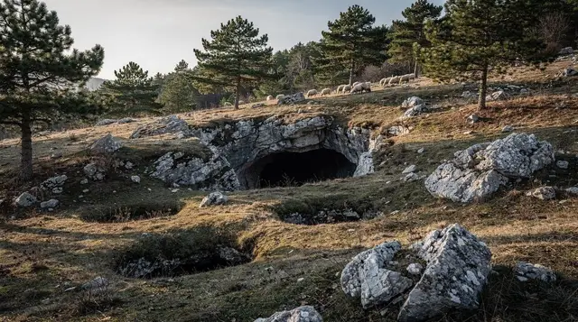
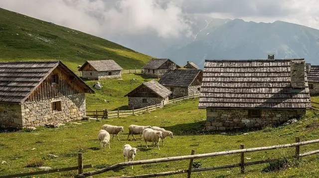
Sutjeska National Park was established in 1962, which makes it the oldest national park in Bosnia and Herzegovina by a wide margin. It sits in the far southeast of the country, hard against the border with Montenegro, wrapped around the valley of the Sutjeska river and its tributaries. Within the park boundary are the two things most visitors come for: Maglić, at 2,386 m the highest peak in Bosnia and Herzegovina, and the Tjentište memorial complex, which marks one of the defining battles of the Second World War in the Balkans.
This page covers the park at the scale most people actually experience it — the drive in, the memorial, the trailheads, the huts, and the logistics of a day trip or an overnight from Sarajevo. The park’s other headline feature, the Perućica primeval forest, gets its own dedicated page because visiting it properly is a different kind of trip: access is restricted to a licensed park guide, group sizes are small, and the forest itself deserves more space than a paragraph here can give it. If old-growth forest is your main reason for coming, start with the Perućica guide rather than this one.
Getting there from Sarajevo
The standard route from Sarajevo runs east through Foča and then south along the Sutjeska valley to Tjentište, around 130 km and about 2h30 in normal traffic. The road is mostly good, two-lane, and scenic for the second half as it climbs into the mountains, though it narrows and slows once you’re inside the park itself.
| How | Time from Sarajevo | Notes |
|---|---|---|
| Self-drive | ~2h30 | Most flexible; see driving in Bosnia and car rental in Sarajevo |
| Guided day tour | ~2h30 each way, full day | Transport, some route knowledge, and often a short guided walk included |
| Bus to Foča + taxi/transfer | ~2h to Foča, then 30-45 min on | Workable without a car but needs planning; see day trips without a car |
There is no scheduled public bus running the length of the park road to Tjentište, so anyone without a car is really choosing between a tour and a taxi arranged from Foča. Given the distance, this is a long day out rather than a quick add-on — for a broader sense of what else is realistic in a day from the capital, see best day trips from Sarajevo.
Maglić and the high peaks
Maglić’s summit, at 2,386 m, is the high point of the whole country, and it sits more or less on the border with Montenegro — Bosnia’s border marker on the peak looks across at a near-identical one a few metres away. Reaching it is a proper mountain day: the usual approach starts from a mountain hut near Trnovačko Lake, a glacial lake at around 1,500 m that is itself one of the more striking short walks in the park, then climbs several hours over rocky, exposed terrain to the top.
This is not a summit for trainers and a bottle of water. Good boots, layers, a start early enough to be off the ridge before any afternoon weather rolls in, and — because the border runs across the summit area — checking current access rules with the park office or a local guide before setting out are all standard practice, not excessive caution. Most visitors who want the peak book a guided ascent rather than navigating alone; a full breakdown of routes, huts, and difficulty is in the dedicated Maglić and the high peaks guide.
a guided hike to Trnovačko Lake with a picnic lunch included is a gentler way to see this part of the park without committing to the full Maglić ascent, and it’s a reasonable option for anyone who wants mountain scenery without a summit-day level of effort.
For overnight stays on the mountain, a handful of basic huts operate in season; see Sarajevo-area mountain huts for how booking and facilities generally work in this part of the country, since the same conventions apply here.
Tjentište and the Battle of the Sutjeska
The village of Tjentište, just off the main road roughly in the middle of the park, is built around the memorial to the Battle of the Sutjeska, fought here in the late spring and early summer of 1943 between Yugoslav Partisan forces and encircling Axis divisions. It was one of the largest and costliest engagements of the wartime resistance in the region, and it became a central episode in Yugoslav wartime memory afterwards.
The monument itself, completed in 1971, is a pair of enormous curved concrete forms set into the hillside above the road — an example of the large-scale memorial architecture built across the former Yugoslavia in the postwar decades, in the same broad tradition as monuments elsewhere in the country. A small museum building nearby sets out the course of the battle.
It’s a quiet, sobering stop rather than a photogenic one, and it rewards a few minutes of actually reading the information on site rather than a drive-by. Readers wanting the wider political and military context of this period, including how it connects to other Yugoslav-era sites around Sarajevo, may find a guided tour covering the rise and fall of Yugoslavia useful preparation, since it’s built to explain exactly this kind of site.
Perućica primeval forest — a park highlight, briefly
Inside the park’s core zone lies Perućica, one of the last old-growth forest remnants in Europe, protected as a strict reserve since long before the national park itself existed. It is a genuine highlight of Sutjeska and one of the reasons the park has the reputation it does among naturalists — but access is deliberately limited to a licensed park guide, on foot, in small groups, and it is not something to attempt to reach independently. Because it needs its own explanation of permits, routes, and what you’ll actually see, the full detail sits on its own page: the Perućica primeval forest guide. Treat it as a separate booking and a separate day from the rest of this itinerary.
Trails, huts and what to expect on the ground
Away from Tjentište and the Maglić approach, the park has a network of marked walking trails at lower elevations, mostly starting from Tjentište or from villages along the valley road. Waymarking is inconsistent by Western European standards — reasonably clear on the main routes, thinner and easy to lose on side trails — so a paper map from the park office or a downloaded GPS track is worth having even on a modest walk.
| Route type | Typical duration | Difficulty | Starting point |
|---|---|---|---|
| Tjentište memorial + short forest loop | 1-2 hours | Easy | Tjentište village |
| Trnovačko Lake | 3-4 hours return | Moderate | Trailhead above Tjentište |
| Maglić summit | 8-10 hours or overnight in a hut | Strenuous | Via Trnovačko Lake hut |
| Perućica (guided only) | Half day to full day | Moderate, guide-paced | Ranger station, by arrangement |
A handful of basic mountain huts operate through the summer season; some close entirely outside June to September, so anyone planning an overnight above Tjentište should confirm opening dates before relying on one. a 4WD and hiking tour into the park from Foča is a practical option for covering more ground in a single day without driving the rougher tracks yourself, and it typically combines a short drive with a guided section on foot.
Wildlife and landscape
The park’s mix of high limestone peaks, glacial lakes, and largely undisturbed forest supports a range of wildlife that has become scarce elsewhere in Europe, including brown bears, chamois, and, in the more remote reaches, wolves and the occasional lynx. Sightings are the exception rather than the rule for a day visitor — this is dense terrain and the animals keep their distance — but the presence of large predators is one more reason not to wander off marked routes without a guide, on top of the safety point below.
Landmine safety — read this before hiking off the main paths
Bosnia and Herzegovina still has suspected minefields left over from the 1992-1995 war, concentrated in rural, forested, and mountainous terrain — exactly the kind of ground much of Sutjeska covers. The rule for the whole park, and for hiking anywhere in this part of the country, is simple and non-negotiable: stay on marked trails and roads, respect yellow and red warning signs without exception, and use a licensed guide for anything beyond the main waymarked routes, especially near the forest edges and away from Tjentište.
This applies as much to a short detour for a photo as to a full day’s hike. See landmine safety for hiking in Bosnia for the fuller picture, which is worth reading before any hiking trip in this country, not only this one.
When to go
June to September is the reliable window: mountain huts are open, the higher trails and the Maglić approach are generally clear of snow, and Perućica guiding runs on a normal schedule. May and October can still work for Tjentište and the lower valley, but expect closed huts, cooler weather, and a real chance of snow lingering on or returning to the summit ridge. Outside that window, from November to April, this becomes a winter mountain environment and is not a casual day-trip destination — see the best time to visit Sarajevo and the surrounding region for how this fits against the rest of a Bosnia trip’s seasonal planning.
Where to stay
For a single long day from Sarajevo, staying in the capital and driving out and back works fine — Foča is roughly the halfway point and has the widest choice of guesthouses if a night on the way suits the itinerary better. Tjentište itself has a small motel and restaurant right by the memorial, useful for an early start on Maglić the next morning. Anyone heading up toward Trnovačko Lake or the summit should plan on a mountain hut instead, booked in advance through the park office or a local operator.
If Sutjeska is one stop on a longer loop through eastern Bosnia, it pairs naturally with Višegrad and the Mehmed Pasa Sokolovic bridge, or with a wider circuit covered in Bosnia nature week or the seven-day Bosnia road trip.
Travellers building a themed history day around Tjentište sometimes also look at nearby Kraljeva Sutjeska — a different place entirely, a historic royal-era village near Vareš rather than anywhere inside this park, reachable on a day trip to Kraljeva Sutjeska and the Bobovac fortress — worth flagging simply because the shared name causes real confusion when planning.
Questions about visiting Sutjeska National Park
How far is Sutjeska National Park from Sarajevo?
Around 130 km, roughly 2h30 by car via Foča. There is no direct public transport into the park itself, so most visitors either drive, join a guided tour from Sarajevo, or take a bus to Foča and arrange onward transport from there.
Can I visit Sutjeska National Park without a car?
It is possible but slower. Buses run from Sarajevo to Foča, which sits at the edge of the park, but getting on to Tjentište or the trailheads from Foča needs a taxi, a pre-arranged transfer, or a day tour that includes transport.
Do I need a guide to see the Perućica primeval forest?
Yes. Perućica is a strictly protected reserve inside the park and access is only permitted with a park guide or ranger. See the dedicated Perućica guide for how to arrange this.
Is climbing Maglić difficult?
It is a serious mountain day, not a stroll: several hours of ascent on rough terrain to reach 2,386 m, usually done from a mountain hut near Trnovačko Lake. Fitness, proper boots, and checking conditions and border-area access rules beforehand all matter.
Are there landmines in Sutjeska National Park?
Bosnia and Herzegovina still has suspected minefields in rural and mountain areas from the 1990s war, and the region around Sutjeska is no exception. Stay on marked trails and roads, respect warning signs, and use a guide for anything off the main paths.
What is the Tjentište monument?
A pair of large concrete wings built in 1971 to commemorate the Battle of the Sutjeska, a major 1943 engagement between Yugoslav Partisans and Axis forces fought in these valleys. It stands in the village of Tjentište, just off the main road through the park.
When is the best time to visit?
June to September, once snow has cleared from the higher trails and mountain huts are open. May and October can still work for the lower valley and Tjentište, but expect closed huts and possible snow on Maglić outside summer.
Where should I stay near the park?
Foča has the most guesthouses and services and works well as a base. Tjentište itself has a small motel-restaurant, and hikers heading for Maglić usually overnight in a mountain hut near Trnovačko Lake instead.