Sutjeska National Park: Maglić, Perućica and Tjentište
What is Sutjeska National Park known for?
Sutjeska is Bosnia and Herzegovina's oldest national park, home to Maglić (2,386m), the country's highest peak, and Perućica, one of Europe's last primary forests, which can only be entered with a park guide. It sits on the Montenegrin border, roughly 130km and about 2 hours 30 minutes from Sarajevo.
The oldest protected wilderness in Bosnia and Herzegovina
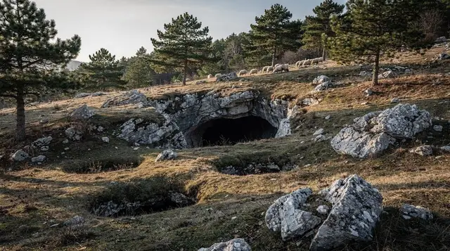
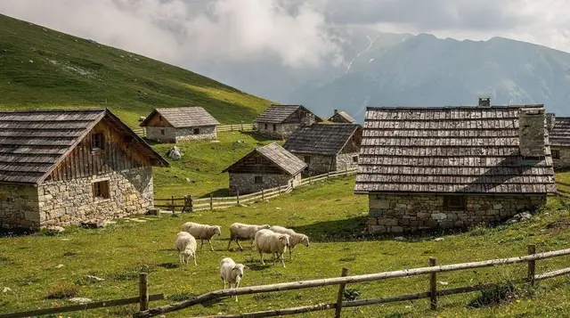
Sutjeska National Park was established in 1962, which makes it the oldest national park in the country, and it sits hard against the Montenegrin border in the far south-east of the Federation, threaded by the Sutjeska river it’s named after. Three things bring visitors here, and they’re genuinely different trips rather than stops on one itinerary: the climb up Maglić (2,386m), the country’s highest point; a guided walk into Perućica, one of the last stretches of primary — never logged — forest left standing in Europe; and the memorial complex at Tjentište, built for a Second World War battle fought in these valleys in June 1943.
It’s a proper day out from Sarajevo, not a quick detour. Reckon on roughly 130km and about 2 hours 30 minutes each way by car via Foča. That makes the park a long single day trip or, better, a one-night stop if you actually want to walk into Perućica or get up Maglić rather than just see the valley floor and the monument from the road.
Getting there from Sarajevo
There’s no direct bus or train to Tjentište, and driving is the practical way in. The route runs south-east out of Sarajevo through Konjic and Jablanica, or via Foča, depending on which road is running better that season, then climbs into the Sutjeska valley on mountain roads that are narrow and slow rather than technically difficult. If you’re driving yourself, read driving in Bosnia and sort a car rental in Sarajevo a few days ahead, since automatics and anything with genuine ground clearance thin out fast once the season gets busy.
a guided 4WD and hiking day into the park from Foča covers the same ground without the logistics, which matters more here than in most of Bosnia: several of the park’s best viewpoints and the Perućica trailhead sit on unpaved forest tracks that a small rental hatchback won’t enjoy, and a local driver already knows which fork in the road actually goes somewhere.
| From Sarajevo | Distance | Driving time |
|---|---|---|
| Tjentište (park entrance) | ~130km | ~2h30 |
| Foča | ~90km | ~1h45 |
| Konjic (route via) | ~60km | ~1h |
Maglić: the roof of Bosnia and Herzegovina
At 2,386m, Maglić is the highest point in the country, and it looks the part: a grey limestone pyramid rising straight out of forest, with Montenegro’s Volujak range filling the view to the south. The standard route starts from the Prijevor pass inside the park and climbs around 1,000m of ascent over several hours, on a trail that’s marked but rough underfoot in places — this is a mountain day for hikers who are already fit and comfortable navigating on rock, not a warm-up walk tacked onto a city break.
Most people who want the summit rather than just the lower trails plan for a night at one of the park’s mountain huts — Dragoš-sedlo, below the ridge near Trnovačko Lake, is the usual base — splitting the climb over two days rather than racing up and down in a single push from Sarajevo. If that’s not your trip, the park still rewards a shorter walk from Prijevor towards the ridge, with views back over the lake and into Perućica’s canopy, without committing to the full summit.
Background on huts, water sources and what to actually carry is in Sarajevo’s mountain huts and the broader hiking around Sarajevo guide, and the general rule for hiking anywhere off a paved road in this country belongs in your head before you set out: read landmine safety for hiking in Bosnia and stay on marked trails, full stop.
Trnovačko Lake: the easier reward
Below Maglić’s north face sits Trnovačko Lake, a glacial lake at altitude that’s a genuinely manageable walk compared with the summit — a half-day round trip rather than a mountaineering day, through forest and alpine meadow to water that’s cold, clear and rarely crowded even in August. It’s the best single outing in the park for visitors who want the high-mountain scenery without the exposure of the Maglić ridge, and it doubles as the first stretch of the summit route if you decide to go further another day.
a guided hike to Trnovačko Lake with a picnic lunch included is the straightforward way to do it from Sarajevo: transport, a guide who knows the trail and the park’s access rules, and food sorted, which matters on a day that already runs long once you add the drive at both ends.
Perućica: the forest you cannot walk into alone
This is the point to be direct about: Perućica is not a self-guided trail. It’s one of the last primary forests remaining in Europe, a strictly protected core reserve inside the wider national park, and entry is only permitted with a park guide arranged through the visitor centre at Tjentište.
Turning up and following a path in on your own isn’t an option, and the park enforces that rule for a reason that has nothing to do with tourism management: this is one of the last places on the continent where you can see what lowland European forest looked like before it was ever cut, with beech and spruce well over 300 years old and a canopy that’s never been opened by a chainsaw. Brown bears, wolves, lynx and chamois all still live in the reserve, which is itself part of why access is controlled rather than a bureaucratic hurdle for its own sake.
Guided visits typically follow a boardwalk and marked path along the edge of the reserve to a viewpoint over a waterfall inside Perućica — not to be confused with the separate, much smaller Skakavac waterfall near Sarajevo, which is one more place in this country where the same name gets reused for two entirely different spots. Book your Perućica guide ahead in peak season through the Tjentište visitor centre; walk-up availability isn’t reliable, and a wasted trip out here is a genuinely long one to repeat.
Tjentište and the Battle of the Sutjeska
The valley floor at Tjentište carries a large Yugoslav-era memorial: two sculpted concrete wings set into the hillside, built for the Battle of the Sutjeska, fought here in June 1943 when Yugoslav Partisan forces broke out of an Axis encirclement at heavy cost. There’s a small museum alongside the monument covering the battle in more detail. It’s worth the stop for what it is — a serious, largely unvisited Second World War memorial in a striking natural setting — rather than for a photograph; treat it the way you’d treat any war memorial, without a checklist mentality about it.
Not the same place: Kraljeva Sutjeska
One genuine source of confusion is worth clearing up before you book anything: Kraljeva Sutjeska, a village near Kakanj with the remains of the medieval Bosnian royal court and the tomb of the last Bosnian queens, is not Sutjeska National Park. They share a name and nothing else — Kraljeva Sutjeska sits over 100km the North-West of the park, closer to Travnik than to Maglić, and the two places have no road connection worth making in one day.
If what you actually want is the medieval history rather than the mountains, a day trip to Kraljeva Sutjeska and the Bobovac fortress ruins is the one to book, not anything with “Sutjeska National Park” in the title.
Where to base yourself
There isn’t much accommodation inside the park itself: a modest motel near the Tjentište entrance and a couple of mountain huts higher up are effectively the only beds. Most visitors either day-trip from Sarajevo, overnight in Foča and go in early the next morning, or, if they’re climbing Maglić, book a bed at Dragoš-sedlo hut for one night to break the ascent in two. Foča itself is also the usual jumping-off point for rafting on the Tara — see rafting the Tara from Sarajevo if a river day is on your list alongside the mountains, since the two combine naturally on the same stretch of road.
Practicalities: permits, weather and what to pack
Guiding for Perućica and current route information for Maglić are both handled at the park’s visitor centre in Tjentište, and it’s worth checking trail conditions there directly rather than relying on anything printed, since access to the high routes closes with late snow most years. Bring cash; card acceptance thins out fast once you’re off the main road, including at the visitor centre and any hut. Layers matter even in midsummer: Tjentište sits low in a river valley, but the Maglić ridge and Trnovačko Lake are both well over 1,500m, and the temperature swing between the two in a single day is real. Sturdy boots, not trainers, for anything beyond the monument and museum.
| Activity | Typical duration | Guide required |
|---|---|---|
| Perućica forest viewpoint walk | Half day | Yes, always |
| Trnovačko Lake | Half day | Recommended |
| Maglić summit | Full day to two days | Recommended; effectively mandatory solo off-season |
| Tjentište monument and museum | About 1 hour | No |
Where Sutjeska fits in a Bosnia trip
Sutjeska is the mountain-and-forest half of Bosnia’s nature, and it’s worth pairing rather than treating as a stand-alone errand from Sarajevo. Anyone building a longer trip around hiking and rivers should read Una National Park alongside this page — Una is gorges and turquoise water in the the North-West, Sutjeska is high peaks and old-growth forest in the south-east, and the two don’t overlap in what they show you.
A nature-focused week in Bosnia is the natural frame for combining them without rushing either, and the wider best day trips from Sarajevo roundup places Sutjeska against shorter, easier options in case a five-hour round-trip drive turns out to be more than your schedule can absorb on this visit.
Sutjeska National Park FAQ
Can I visit Perućica forest without a guide?
No. Perućica is a strictly protected primary forest reserve inside Sutjeska National Park, and independent entry isn’t permitted. Guided access is arranged through the park’s visitor centre at Tjentište, with rangers rather than general tour guides leading the way.
How far is Sutjeska National Park from Sarajevo?
Around 130km, roughly 2 hours 30 minutes by car via Foča. There’s no direct public transport link, so most visitors drive, rent a car, or join an organised tour that includes transport.
Is Kraljeva Sutjeska the same place as Sutjeska National Park?
No, and the shared name causes real confusion. Kraljeva Sutjeska is a village near Kakanj with the ruins of a medieval Bosnian royal court; Sutjeska National Park is the mountain and forest reserve on the Montenegrin border, over 100km away. Check which one a tour actually visits before booking.
How hard is it to climb Maglić?
It’s a genuine mountain day, not a stroll: a marked but rough trail, around 1,000m of ascent from the usual trailhead, and several hours each way. Fit, experienced hikers manage it in a long day; less experienced walkers should plan an overnight at a mountain hut and go with a guide.
What is the Tjentište monument?
A large concrete memorial complex marking the Battle of the Sutjeska, fought here in June 1943 between Yugoslav Partisan forces and Axis troops. It includes two sculpted concrete wings on the valley floor and a small museum.
Are there landmines in Sutjeska National Park?
The marked trails, huts and guided routes described on this page are cleared and used regularly without incident. The rule for the whole country still applies away from them: stay on marked paths, and don’t wander into unmarked or overgrown ground — one of the reasons Perućica requires a guide.
When is the best time to visit Sutjeska National Park?
Late June to September. Snow can linger on the Maglić ridge and around Trnovačko Lake into early June, and the high routes are worth checking with the visitor centre before you commit to the long drive.
Hiking & nature tours on GetYourGuide
Verified deep-linked GetYourGuide tours. Book through these links and we earn a small commission at no cost to you.
GetYourGuide does not provide a product photo for this activity — the image shows the meeting point, photographed by us.