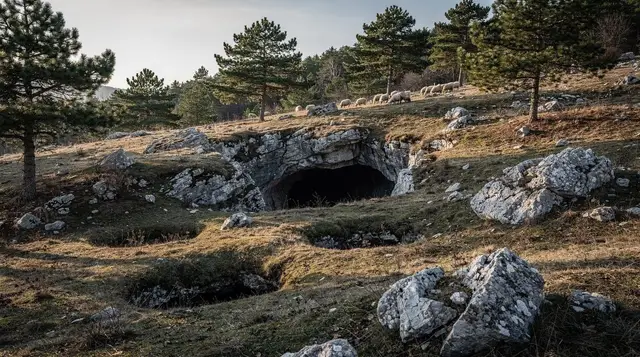
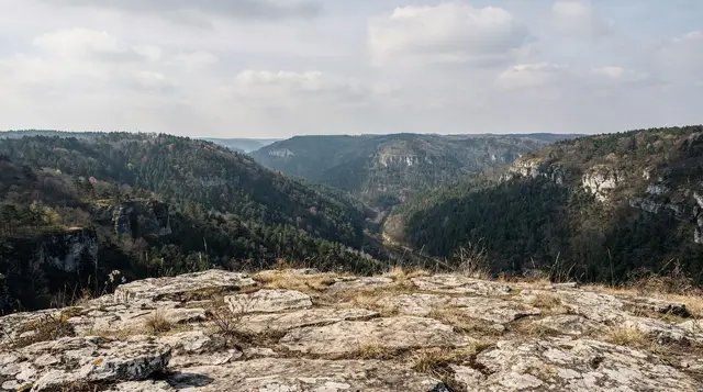
Maglić and the high peaks of Sutjeska National Park
Do I need a guide for Maglić or Perućica forest in Sutjeska National Park?
Perućica primeval forest can only be entered with a licensed park ranger — there is no independent access, full stop. Maglić's summit trail can be walked without a guide by experienced hikers in good conditions, but it is 130km and roughly 2.5 hours' drive from Sarajevo, with a long, unmarked-in-places ascent, so it is not something to improvise on a whim.
Bosnia’s oldest national park, and its highest peak
Sutjeska National Park was established in 1962, which makes it the oldest protected area in Bosnia and Herzegovina, and it sits about as far from a casual afternoon out as this country gets. The park straddles the border with Montenegro in the far south-east, built around two mountain massifs — Maglić and Zelengora — plus the Sutjeska river valley that gives the park its name. Maglić reaches 2,386m and is the highest point in Bosnia and Herzegovina, its summit ridge shared with Montenegro. This is not an extension of a city walk. It is a genuine mountain destination that happens to be reachable from Sarajevo in a morning’s drive, and it rewards people who treat it as one.
Most visitors come for one of three things: the ascent of Maglić itself, the guided walk into Perućica primeval forest, or the Tjentište monument and valley, which can be seen with far less effort. It is entirely possible to do all three on the same trip, but they are not equally demanding, and conflating them is how people end up under-prepared on a mountain that does not forgive that.
Getting from Sarajevo to Sutjeska
The park’s main village and visitor hub, Tjentište, is 130km from Sarajevo, a drive of roughly 2 hours 30 minutes on mostly good but winding mountain roads. There is no fast route — you are driving through the Neretva and Sutjeska valleys, past Foča, not along a motorway. A car is close to essential: public bus connections from Sarajevo to Tjentište exist but are infrequent and not built around a day of hiking, so unless you are joining an organised tour with its own transport, plan on renting a car in Sarajevo or driving yourself and expect a full day for the round trip alone if you are not staying overnight.
For a first taste of the region’s mountains and gorges without the commitment of Maglić, a guided day trip is a reasonable compromise. A 4x4 day trip into the Zelengora massif with a barbecue lunch covers rough tracks a rental car has no business attempting, and gets you into genuinely remote scenery without a multi-day itinerary.
If you want the detail on the valley itself, our Sutjeska and Perućica guide goes deeper on the lower trails, and the Sutjeska National Park destination page and Perućica forest page give a shorter overview. Think of this page as the high-mountain companion to those two: it is about the ascent, the weather margin and the decision of how much of the park to take on.
Perućica primeval forest: guide only, no exceptions
Perućica is a strict nature reserve inside Sutjeska National Park, and it is one of the last remaining tracts of primeval forest in Europe — trees left untouched for centuries, some of the tallest in the Balkans, with the kind of tangled, multi-layered canopy that managed forest never develops. It is genuinely rare, and the park treats it accordingly.
This is the point to be precise about, because it trips visitors up: you cannot walk into Perućica on your own. Access is only permitted with a licensed park ranger, arranged through the national park’s visitor centre in Tjentište. There is no self-guided option, no marked trail you can quietly follow without one, and no way around this that a persuasive conversation at the gate will change.
Book ahead where you can, especially in July and August when demand is highest and ranger availability is limited; a same-day request in peak season sometimes works, but it is not something to rely on if your schedule is tight. The guided walk typically takes a few hours and covers only the accessible fringe of the reserve — the deep interior is closed even to guided groups, which is exactly why the forest has survived this intact.
Climbing Maglić: what it actually involves
The standard route to Maglić’s summit starts from the area around Trnovačko Lake, a glacial lake tucked beneath the massif that most hikers treat as a waypoint or an overnight base rather than the destination itself. From there, the ascent gains well over a thousand metres of elevation on a trail that is clear lower down and thinner — cairns rather than painted markers — as you climb above the treeline toward the ridge. The summit sits on the Montenegrin border, and on a clear day the view takes in the Sutjeska valley, the Zelengora ridgeline, and the Durmitor massif across the frontier.
None of this should be attempted as a spontaneous add-on to a Sarajevo city break. This is a route for hikers who already have mountain experience: sturdy boots, layered clothing for a summit that runs noticeably colder and windier than the valley, enough water and food for a long day, and a realistic sense of your own pace. Weather on Maglić turns quickly, and afternoon thunderstorms in July and August are common enough that starting early and being willing to turn back is not caution for its own sake — it is how people avoid being caught on an exposed ridge in a storm. If you are not confident navigating an unmarked alpine trail, this is exactly the kind of ascent worth doing with a guide rather than a route description.
A guided hike to Trnovačko Lake with a picnic lunch included is the sensible way to see the approach to Maglić without committing to the summit push, and it is also a solid option on its own for anyone who wants a serious mountain day without the full ascent.
Planning the day around the mountain
The practical logic of a Maglić day is simple: everything depends on starting early and keeping a margin. Decide before you leave the valley where your turn-back point is, and stick to it even if the summit looks close. Walk at a pace you could hold all day rather than the pace of the first hour, eat and drink before you feel you need to, and keep a warm layer and rain protection within reach rather than at the bottom of the pack. Hikers who have done the Trebević trails or the Visočica and Obalj routes near Sarajevo will recognise the rhythm, but Maglić asks for more of it: more distance from help, thinner marking and a summit that is far less forgiving of a late start.
If the weather looks unsettled when you wake, the honest answer is to swap the summit for something lower. The approach to the lake, a walk in the valley or a guided ranger visit to Perućica all remain good days out in conditions that make the ridge a bad idea. Nobody on the mountain will think less of you for changing the plan.
Sharing the mountain with the Zelengora side
Maglić is only one half of the park. Zelengora, the other massif, has a quieter, more rolling character, with long ridgelines and remote scenery that suit people who want distance and silence more than a summit. It is the reason the 4x4 trips above exist: much of that ground is simply too far from a road to reach in a day on foot. If your group has mixed ambitions, one person can aim for the summit while others take the gentler lower route, and everyone can meet again in the valley.
The Tjentište monument
Beside the main road through the valley stands the Tjentište monument, two enormous grey concrete wings marking the Battle of Sutjeska, fought here in June 1943. Tito’s Partisan forces, encircled by a much larger Axis operation, broke out at heavy cost in one of the defining battles of the Yugoslav resistance.
The monument is Yugoslav-era brutalist architecture at its most deliberate — built to be seen from a distance, not to be pretty — and it is worth the short stop most people give it on the way into or out of the park. It sits at valley-floor level, requires no hiking, and takes perhaps twenty minutes including the walk up its steps. It asks nothing of the visitor beyond that: no photo pose, no additional narrative required, just a look at what the valley has been through.
The monument makes more sense if you already know a little about the war that shaped the region’s twentieth century. Our guide to Yugoslav heritage in Sarajevo and the Tito bunker visiting guide set the same period in context, and Bosnian war context for visitors helps if you want the wider background before you drive south. Arriving with that context turns a quick roadside stop into something more considered.
When to go
| Window | Conditions |
|---|---|
| June | Lower trails open; snow can still linger on Maglić’s upper slopes and ridge in a heavy winter |
| July–August | Most reliable window for a summit attempt; warm valley, cooler ridge, afternoon storms possible |
| September | Good hiking weather, fewer people, days shortening — start earlier |
| October onward | Snow can return to the high ground with little warning; not the season for Maglić without winter mountaineering experience |
Outside June to September, treat Maglić’s summit as off the table unless you are equipped and experienced for winter mountain conditions. Perućica’s guided walks run on a shorter season too, since ranger access depends on the same weather. If your trip falls outside this window, Tjentište and the monument are still visitable, but set expectations accordingly and check conditions with the park before driving down.
Who this trip is actually for
Be honest with yourself about which version of this day you want, because the park genuinely offers three different levels of commitment:
| Activity | Effort | Guide required |
|---|---|---|
| Tjentište monument and valley | Easy, no hiking | No |
| Perućica primeval forest walk | Moderate, a few hours | Yes, always |
| Maglić summit | Hard, full day, significant elevation gain | Recommended for anyone without alpine experience |
If you want mountain scenery and a proper walk without the altitude and navigation demands of Maglić, the park’s lower trails and the approach to Trnovačko Lake deliver plenty on their own. If you specifically want the highest point in the country, budget the time, the fitness and the weather margin it needs, and consider staying overnight near the park rather than trying to fold it into a single long day from Sarajevo.
Fitting Sutjeska into a wider trip
Because the drive is long, Sutjeska works best as a deliberate part of a plan rather than a gap-filler. If you have only a few days, the best day trips from Sarajevo are mostly easier and closer, and it is worth reading them before committing a whole day to the road. If you are weighing a guided option against doing it yourself, guided tour vs independent travel in Bosnia lays out the trade-offs, and day trips without a car covers the options if you would rather not drive. Travellers building a longer route can also look at the Bosnia road trip itinerary, which suits a stop in the south-east, and at Sarajevo mountain huts for how overnight stays in the high country tend to work.
Practicalities and where to stay
Tjentište has a small hotel and a limited number of guesthouses, plus a mountain hut used as a staging point for Maglić — none of it plentiful, and July and August fill up. Book ahead rather than arriving and hoping, particularly if a Maglić attempt means you need to be moving before dawn. Mobile signal is patchy once you’re off the main road and thins further on the ascent, so tell someone your planned route and expected return time before you set off, the way you would for any serious mountain day.
The general safety rule for the Bosnian countryside — stick to marked trails and managed ground — applies here as everywhere else outside the cities; the park’s own trails are walked regularly and considered safe, but that is precisely because people stay on them.
Pack for a mountain, not for Sarajevo’s old town: proper boots, a warm layer even in summer, rain protection, and enough food and water for a full day with no shops along the way. Our general Sarajevo packing list covers the basics, but Maglić specifically calls for hiking gear you would use on any serious alpine day, not just city-trip layers.
If you want the mountains without the commitment
Sutjeska is a serious undertaking, and it is fair to want a lighter version of “Bosnia’s mountains” without giving up a full day and a long drive. A few honest alternatives closer to Sarajevo:
- The Bjelašnica massif offers accessible summer hiking 30km from the city, with far shorter drive times and easier logistics.
- Lukomir, the country’s highest permanently inhabited village, gives a taste of the high country without technical terrain — see the offroad 4x4 tour to Lukomir village for a version that needs no hiking at all, or book directly: an offroad 4x4 tour to Lukomir village.
- Via ferrata routes near Sarajevo give a controlled taste of exposed mountain terrain with fixed protection rather than open alpine navigation — the via ferrata route on Bukovik, closer to the city is a shorter, more accessible alternative to a Maglić-scale day.
For general orientation on the region’s trails and what each one actually demands, our hiking around Sarajevo guide sets Sutjeska in context against the other mountain options within reach of the city, and Una National Park is worth comparing if water and canyon scenery matter more to you than summit altitude. For a longer nature-focused trip that fits Sutjeska into a wider loop, see our Bosnia nature week itinerary.
If you are travelling with younger people, Bosnia with teenagers and family day trips from Sarajevo are better places to start than a Maglić summit day, and the valley and monument are the realistic part of Sutjeska for them. For a gentler guided day on the high plateau, a guided highlands path hike with lunch keeps the navigation and logistics in someone else’s hands.
None of this is a park to rush. Give Maglić the day it needs, book Perućica’s ranger ahead of time, and treat the Tjentište monument as the quiet stop it is rather than a photo opportunity — the valley has earned that much.
Mountain excursions on GetYourGuide
Verified deep-linked GetYourGuide tours. Book through these links and we earn a small commission at no cost to you.
GetYourGuide does not provide a product photo for this activity — the image shows the meeting point, photographed by us.