Landmine safety for hiking in Bosnia and Herzegovina
Is it safe to hike in Bosnia and Herzegovina because of landmines?
Sarajevo itself is not affected. Rural and forested parts of the country still have areas of suspected landmine contamination left over from the 1992-95 war, so the rule is absolute: never leave marked trails or well-used areas, always heed yellow and red warning signs, and hire a certified guide for any hike off a known route.
A legacy of the 1992-95 war
The single fact that matters most for anyone hiking in Bosnia and Herzegovina is this: the country still has areas of suspected landmine contamination, left behind by the 1992-95 war, and clearance work is still going on decades later. This is not a reason to avoid the country or its mountains. It is a reason to follow one simple rule everywhere you go outside a town: stay on marked trails and in areas that are visibly and regularly used by other people.
The contamination is not spread evenly. It is concentrated in rural and forested terrain — old front lines, former military positions, abandoned farmland, and the edges of forests that were fought over — rather than in cities. Sarajevo’s streets, Bascarsija, the Sarajevo cable car up to Trebevic, and the tram lines that run the length of the valley are not landmine areas. The risk this page describes applies once you leave built-up ground and head into rural hillsides, forests and disused paths, which is exactly the kind of terrain that draws hikers to Bosnia in the first place.
This page exists so that every other guide on this site covering hiking, nature or mountains can link back to one clear reference rather than repeating the safety information in shorter, less complete form each time. If you read nothing else before a hike in rural Bosnia, read this.
The one rule that matters
Never leave marked trails or well-frequented areas. That is the whole rule, and it covers almost every situation a visitor will encounter.
In practice, that means:
- Walk on the path, not beside it, even when the path is muddy, narrow or crowded.
- Do not cut corners on switchbacks, do not wander off to get a better photo angle, and do not follow an animal track or an old forestry track that peels away from the main trail.
- Treat an unmarked shortcut with suspicion even if you can see other footprints on it — footprints do not certify ground as cleared.
- Keep dogs on a lead in rural and mountain areas; an off-lead dog cannot read a warning sign.
- If a trail is signed as closed, seasonal, or under maintenance, do not treat that as a suggestion.
This rule is not specific to any one valley or mountain. It applies on Bjelasnica, around Lukomir, in the Rakitnica canyon, inside Sutjeska National Park and the Perucica old-growth forest, in Una National Park, and on any forest road or disused track you might be tempted to explore between them.
Reading the warning signs
Minefield markers in Bosnia and Herzegovina are usually metal or plastic signs, red or yellow, sometimes official and sometimes hand-painted by villagers decades ago, often showing a skull symbol or the word MINE. As a rough guide, red generally indicates a confirmed hazard and yellow a suspected one, though the distinction matters less to a visitor than the instruction that follows either colour: stay away, stay on the path, do not go around the sign to see what is on the other side.
The practical problem is that signs age. Some have rusted, faded, fallen over, or been swallowed by undergrowth in the thirty-plus years since they were placed. A missing or unreadable sign is not proof that ground is safe — it is a reason to lean harder on the first rule and stick to paths that are clearly established, maintained and walked by other people, rather than trying to read the terrain yourself.
| What you see | What it means | What to do |
|---|---|---|
| Red or yellow sign with a skull or “MINE” | Confirmed or suspected hazard | Stay on the path, do not approach, do not photograph up close |
| Faded, fallen or unreadable old sign | Still treat as a hazard marker | Do not assume it is outdated; keep your distance |
| A metal object, wire, or unusual shape in undergrowth off-trail | Possible unexploded ordnance | Do not touch or move it; retreat along your own footprints |
| A maintained, waymarked national park trail | Regularly used, cleared route | Normal caution; stay on the path as you would anywhere |
| An old forestry track or unmarked shortcut off the main trail | Unknown status | Do not take it, regardless of how tempting it looks |
Where this matters most
A handful of areas come up repeatedly in local safety guidance, precisely because they are also some of the most rewarding hiking country near Sarajevo. None of them are off-limits — they are hiked constantly by guided groups and by locals who know the ground — but each rewards a guide rather than improvisation.
Rakitnica canyon, cutting between Bjelasnica and Visocica, is remote, steep-sided and only lightly waymarked in places. The established route through it is walked regularly; wandering off it into the surrounding slopes is not advisable without local knowledge.
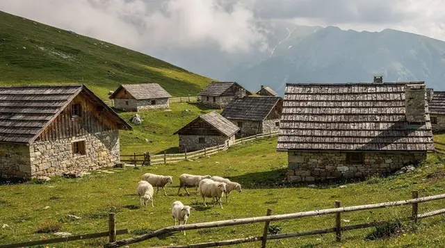
Lukomir, the highest inhabited village in the country, is straightforward to reach on the approach road and the paths immediately around the village. Once you start exploring the open highland pasture beyond the village itself, particularly toward the canyon rim, local guidance is worth having rather than optional.
Sutjeska National Park and the Perucica forest are the country’s oldest protected area and one of the last primeval forests in Europe. Access to Perucica specifically requires a park ranger, which removes any ambiguity: you simply do not enter without one.
Elsewhere — Trebevic’s slopes above Sarajevo, the Vrelo Bosne springs at Ilidza, Skakavac waterfall, and the show caves at Bijambare — the paths are short, well-used and effectively no different from any other maintained trail in Europe. The caution in this article is about remote, rural, forested and rarely-visited ground, not about every green space within reach of the city.
Planning a hike with this in mind
Most of the work happens before you leave the hotel. Decide on a route that other people actually walk, and choose it for that reason rather than for how empty it looks on a map. A trail that is busy with local walkers, shepherds and guided groups is, in practical terms, the best evidence a visitor can have that the ground is in regular use. A quiet corner that appears on no waymarked route is quiet for a reason, and sometimes that reason is that nobody has a mandate to send people there.
It also helps to read a little about the places you plan to walk. The guide to hiking around Sarajevo lays out the routes that are straightforward for visitors, and the Sarajevo mountain huts guide is useful if you want a base where the staff know the surrounding paths and can tell you what is currently walked. Hut keepers and village hosts are often the best source of current local knowledge, and asking them a direct question about the route you have in mind costs nothing.
If you are comparing ways to get into the mountains, the guided tour versus independent travel comparison is worth a read. Safety is one of several honest reasons to choose a guide in rural Bosnia, alongside navigation, transport and the simple pleasure of having someone explain the landscape.
Understanding why the ground looks the way it does
It can help to know why this problem exists, because it explains where the caution matters. The war left front lines running through hills, woods and fields that were later abandoned or only partly returned to use. Mines were laid around positions, along ridges and at the edges of settlements, and not every field was recorded precisely. Much of that land is now covered by regrowth, which is why an overgrown meadow or a quiet forest edge can look entirely innocent. Nature has quietly hidden the evidence, and that is why visual judgement is not enough.
For a broader sense of the history behind this, the Bosnian war context for visitors is a good companion read, and the Srebrenica memorial visiting guide deals with another part of the country where the past is very present. Reading about it is a way of showing respect for the people who still live next to this ground every day.
Respecting the people who live here
Many villagers in mountain areas have learned to live alongside contaminated land, and they take the matter seriously without making a drama of it. If a farmer waves you away from a field, or a shepherd tells you which path to take, treat that as expert advice rather than fussiness. Do not argue, do not ask to be shown the “interesting” place off the track, and do not treat a warning as an invitation to look closer. A brief greeting and a question about the way is usually welcomed.
The same attitude applies to photography and curiosity. Warning signs are not attractions, and the land behind them is not a backdrop. The visiting Sarajevo respectfully guide covers the wider etiquette, and the local views on war tourism give a sense of how residents feel about visitors treating the war’s legacy as a spectacle.
Weather, seasons and ground conditions
Conditions change what a trail looks like. Snow can hide a path, and with it the edges that tell you where the maintained route ends. In the thaw and after heavy rain, tracks blur, streams shift and muddy ground tempts walkers to step around the worst of it. That is exactly the moment to resist the urge to detour. If a path is waterlogged, walk through it or turn back; do not make a new line beside it.
Seasonal planning matters too. The best time to visit Sarajevo and the Bjelasnica summer guide both help you choose a window when trails are clear and easy to read, and the Sarajevo packing list covers the sturdy footwear and layers that make staying on the path comfortable rather than a chore. Good boots, a charged phone and a downloaded offline map are the unglamorous items that keep a walk simple.
Getting there and getting back
Plenty of risky decisions begin with a logistics problem: a missed bus, a late start, a wrong turn that leaves you improvising in fading light. Plan your return before you set out. The day trips without a car guide and the driving in Bosnia guide explain how to reach the mountains and, just as importantly, how to leave them on time. If you drive, park only in clearly established places and avoid pulling onto unmarked verges or old tracks, which are best left alone. The car rental in Sarajevo guide helps if you are still deciding how to travel.
Start early, tell someone your route, and turn around while you still have comfortable daylight. A rushed finish is when people take shortcuts.
Sarajevo itself: no need to worry
It is worth repeating plainly: Sarajevo intra-muros, the city where almost every visitor spends most of their time, is not a landmine area. You can walk Bascarsija, Ferhadija, the riverside paths along the Miljacka, and the residential hillside streets of Alifakovac without this topic being relevant at all. The Sarajevo cable car up to Trebevic and the paths immediately around its upper station are also regularly used and maintained. The concern in this article is specifically about rural, forested and remote terrain once you leave the city and its immediate, well-trodden surroundings, which is covered in more detail in our broader guide to whether Sarajevo is safe.
Hiking with a guide: when it pays off
For a signed trail inside a national park, or a route run by an established local operator, you do not need special arrangements beyond ordinary hiking sense. For anything off a known route — genuinely off-trail walking, exploring beyond a village’s immediate paths, or heading into Rakitnica, Perucica or the wilder ground around Lukomir — a certified local guide is the right call, and not only for landmine awareness. Guides know current trail conditions, weather windows and, in the case of contaminated ground, exactly which slopes have been cleared and which have not.
If you would rather not plan a route yourself, a guided day out removes the decision entirely. A full-day guided hike around Lukomir village covers the highland approach and the village’s surrounding paths with a guide who knows the ground.
For something higher and further out, a guided day hike on Treskavica mountain with lunch included reaches genuinely remote terrain without the guesswork of route-finding alone. If walking distances are a concern, a private 4x4 safari out to Lukomir covers the same highland scenery from a vehicle, on tracks the driver already knows.
Our dedicated guides go into more depth on specific routes: the full route guide to Lukomir, the Rakitnica canyon trek, the combined Sutjeska and Perucica guide, and Una National Park further west. For an easier, low-risk half-day from the city, see our notes on Trebevic hiking and the wider overview of hiking around Sarajevo.
Hiking with children and groups
Families can enjoy the same mountains, with a few adjustments. Keep children within arm’s reach on any rural path, explain the rule in simple terms before you start, and make staying on the trail part of the game rather than a lecture. Children are naturally drawn to odd objects and hidden corners, so tell them clearly that anything metal or strange is never to be picked up, and that they should call an adult instead. The Bosnia with teenagers guide and the family day trips from Sarajevo suggest outings that suit younger walkers.
In a group, agree on one person who leads and one who walks last, so nobody wanders off the line of the path. Walk single file where the track is narrow, and do not let the group spread across a slope.
If you see something
The correct response to spotting a suspicious object — a rusted metal shape, taut wire, or anything that does not look natural — off a marked path is the same as the correct response to a confirmed sign: do nothing to it. Do not touch it, do not move it, and do not step closer to photograph it. Retreat carefully along the exact line of your own footprints back to the path or to solid, known ground. Note the location as precisely as you can from a safe distance — a nearby landmark, a GPS point if your phone has signal, or a description for your guide.
Report what you saw. If you are with a guide or on an organised tour, tell them immediately. If you are on your own, contact the police on 122 or the general emergency number 112, or report it through your accommodation, which will know the right local contact. Bosnia and Herzegovina’s demining authority coordinates clearance nationally, and a specific, well-located report is genuinely useful to them, not an overreaction.
Practical checklist before a rural hike
- Choose a marked trail, a national park route, or a hike with a reputable local operator.
- Check current conditions and closures before setting out, especially after heavy rain, which can shift ground and expose old hazards.
- Take a guide for Rakitnica, for any ground around Lukomir beyond the village’s immediate paths, and for Perucica, where a park ranger is required regardless.
- Keep dogs leashed once you are out of town.
- Never leave the path to shortcut a switchback, chase a view, or retrieve something dropped nearby.
- Save the emergency numbers before you leave signal: 112 general, 122 police.
- If in doubt about a specific route, ask your accommodation or a local operator rather than guessing from a map.
None of this should overshadow the hiking itself. The highland pastures above Lukomir, the beech and pine of Perucica, the limestone gorges of Una, and the ridgelines around Bjelasnica and Jahorina are genuinely some of the least crowded, most rewarding mountain landscapes left in Europe. The rule that keeps them that way for visitors is a short one — stay on the path — and it is easy to follow once you know it. For a broader look at organising a trip around them, see our roundup of the best day trips from Sarajevo and the Bjelasnica summer guide.
Hiking & nature tours on GetYourGuide
Verified deep-linked GetYourGuide tours. Book through these links and we earn a small commission at no cost to you.
GetYourGuide does not provide a product photo for this activity — the image shows the meeting point, photographed by us.