Cycling around Sarajevo: routes from Vrelo Bosne to Bjelasnica
Where can you cycle around Sarajevo?
The easy ride is the Velika aleja, a flat 3.5 km avenue from Ilidza to Vrelo Bosne, with bikes for hire on site. Fitter riders continue onto the paved roads and forestry tracks toward Trebevic or Bjelasnica, both former Olympic venues, but the climbing is real and unmarked side tracks are a mine risk.
Two rides, not one: pick the flat one or the climb
Cycling around Sarajevo really means two different outings, and it is worth being clear about which one you are signing up for before you rent a bike. The first is the Velika aleja at Ilidza, a flat, shaded avenue that almost anyone can ride. The second is the climb onto the former Olympic slopes of Trebevic or Bjelasnica, which is proper cycling with real elevation, on roads and forestry tracks, for riders who already cycle. This guide covers both, plus where to rent, what it costs, and the one safety rule that matters more here than almost anywhere else in Europe.
The Velika aleja to Vrelo Bosne: the ride almost anyone can do
The easiest and most rewarding short ride near Sarajevo starts at Ilidza, on the western edge of the city, at the source of the Bosna river known as Vrelo Bosne. From the entrance, the Velika aleja runs 3.5 km in a straight, tree-lined avenue to the springs themselves. It is flat, closed to most motor traffic, shaded by mature plane trees that were planted under Austro-Hungarian rule, and wide enough that walkers, cyclists and horse-drawn fiacres share it without much friction. Riding it out and back takes most people 45 minutes to an hour at an easy pace, longer if you stop at the springs, where the Bosna emerges from several channels around small wooded islands.
This is the ride to recommend to a family with children, to anyone who has not cycled in a while, or to a visitor with only an hour or two free between Old Town sightseeing. There is no climbing, no traffic to speak of, and the destination is genuinely worth reaching rather than just an excuse for exercise.
| Route | Distance | Surface | Difficulty | Typical time |
|---|---|---|---|---|
| Velika aleja (Ilidza to Vrelo Bosne, return) | 7 km | Paved avenue, flat | Easy | 45–75 min |
| Ilidza to Stojcevac and the Roman bridge | 12–15 km | Paved lanes, flat to gently rolling | Easy–moderate | 1.5–2.5 hr |
| Sarajevo centre to Trebevic (lower slopes) | 8–12 km one way | Paved road, sustained climb | Moderate–hard | 1–2 hr up |
| Sarajevo centre toward Bjelasnica | 30 km one way | Paved road, then track, sustained climb | Hard | Half day or more |
Getting to Ilidza with a bike, or without one
Ilidza is about 12 km from central Sarajevo, roughly 25 minutes by car and a similar time by tram. Tram line 3 runs from Bascarsija through the city centre out to Ilidza and is the simplest way to get there without a car; it is not set up to carry bikes easily, so most visitors rent once they arrive rather than bring one from the centre. A taxi from Bascarsija to Ilidza runs at the meter rate, broadly comparable to the 20–25 KM you would pay for the airport run, since the distances are similar. If you already have a rental car, there is parking near the Vrelo Bosne entrance.
Renting a bike or e-bike at Vrelo Bosne
Bikes and e-bikes are available for hire right at the entrance to Vrelo Bosne, which is by far the easiest way to do this ride: no need to carry anything on the tram, and no commitment beyond an hour or two. Standard bikes suit the flat avenue itself; an e-bike is worth the extra cost if you plan to continue past Vrelo Bosne onto the rolling lanes toward Stojcevac, or if anyone in your group would otherwise struggle with even gentle gradients.
Sarajevo e-bike rental at Vrelo Bosne covers exactly this: bikes handed over at the springs, ready to ride the avenue or push on further. Expect rental pricing broadly in line with other outdoor activity hire in the area — check current rates when you book, since they are adjusted seasonally.
Beyond Vrelo Bosne: extending the ride to Stojcevac
Fit riders who find the Velika aleja too short can continue past Vrelo Bosne onto the country lanes around Stojcevac, where a Roman-era bridge sits over a side channel of the Bosna in quiet farmland just outside Ilidza. It adds a further 8–10 km round trip on flat to gently rolling paved lanes, still well within reach of anyone who managed the avenue itself, and it turns an hour’s outing into a half-day one with a genuine change of scenery.
a guided ride from Vrelo Bosne out to the Stojcevac Roman bridge covers this extension with someone who knows the lanes, which is useful if you would rather not navigate farm tracks on your own.
Climbing toward the Olympic mountains: Trebevic and Bjelasnica
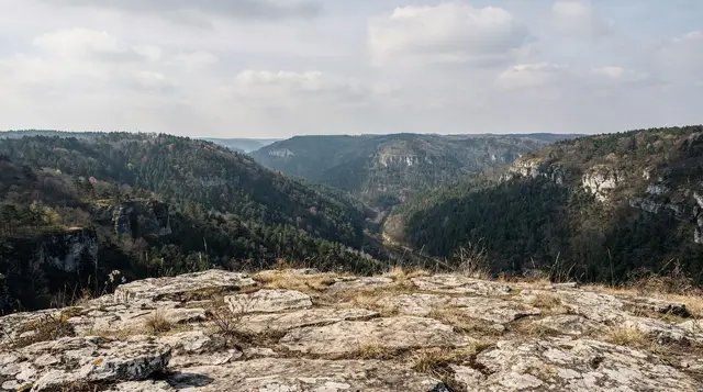
This is where cycling around Sarajevo stops being casual. Trebevic rises directly above the city and can be reached by road from the centre, but the climb is sustained from close to sea level in the Miljacka valley up toward 1,000 metres and beyond, and it should not be underestimated because the mountain looks close on a map. Riders who manage it are rewarded with the same views as the Trebevic cable car passengers get for free, plus a look at the abandoned 1984 bobsleigh track from the road rather than a tourist queue.
Bjelasnica, the men’s alpine skiing venue of the 1984 Winter Olympics, is a bigger undertaking again: 30 km and about 45 minutes from central Sarajevo by car, which gives some sense of scale, since covering the same ground by bike with the accompanying elevation gain takes a fit rider several hours rather than under an hour.
The paved road climbs steadily out of the valley before giving way to forestry track higher up. This is a route for people who already cycle regularly and want a serious day out, not a first Sarajevo outing, and it is sensible to start early, carry more water than seems necessary, and check weather on the mountain separately from weather in the city, since conditions at altitude change fast even in summer.
Neither climb is signposted for cyclists in the way Western European mountain routes often are. A GPS track, or a local operator who already knows the road, removes a lot of the guesswork.
A guided alternative: cycling to the Tunnel of Hope
One of the more popular ways to combine cycling with Sarajevo’s recent history is a guided ride that takes in the Tunnel of Hope near Butmir, close to the airport on the southern edge of the city. The tunnel itself is well documented elsewhere on this site — see the Tunnel of Hope visiting guide for what you actually see inside — but reaching it by bike, on quiet roads through Butmir and Dobrinja rather than by taxi, gives a better sense of how flat and exposed this stretch of the city was during the siege, and why the tunnel mattered as much as it did.
a guided bike tour to the Tunnel of Hope with entry included bundles the ride and the museum ticket together, which is convenient if you would rather not work out the route and the opening hours separately.
Mines, unmarked tracks and where not to freelance
Bosnia and Herzegovina still has landmines suspected on tens of square kilometres of ground, a legacy of the 1992–1996 war that has not been fully cleared. This matters directly for cycling, because the temptation on a bike is exactly the kind of shortcut that causes problems: cutting off a switchback, following an inviting unmarked track through woodland, or leaving a paved road to explore a field. The rule is simple and non-negotiable — stay on paved roads, on signed forestry tracks, and on routes that are visibly used by other cyclists, hikers or vehicles.
Respect any yellow or red warning signage without exception. This applies with particular force on the approaches to Trebevic and Bjelasnica, where wartime front lines ran through exactly this kind of hillside terrain. For a fuller treatment of where this risk is concentrated and how to read the warning signs, see landmine safety for hiking in Bosnia, which applies equally to cycling off the main roads.
What this guide is not: extreme mountain biking
It is worth being honest about scope. This is a guide to road and track cycling for fit, ordinary riders — the Velika aleja, the lanes around Stojcevac, and the climbs onto Trebevic and Bjelasnica by paved road and maintained track. It is not a guide to technical single-track, downhill runs or serious off-road mountain biking, which is not really established as a visitor activity around Sarajevo in the way it is in some Alpine resorts.
If you want a bigger adrenaline hit on similar terrain, a via ferrata or climbing route or a 4x4 jeep safari covers ground a road bike cannot, with a guide managing the technical and safety side of it. Both are a more honest match for anyone specifically after an extreme-sports day than pushing a rented city bike up a mountain track.
When to cycle around Sarajevo
May, June and September into early October are the best months: warm enough to enjoy the ride, cool enough that the climbs toward Trebevic and Bjelasnica do not turn into a slog. July and August work for the flat Vrelo Bosne ride, shaded as it is by the avenue’s plane trees, but the exposed climbs get hot in the valley heat, typically 30–35 degrees.
Winter cycling is not really practical on the mountain routes once snow settles — that is ski season instead, covered in skiing near Sarajevo — and December and January bring the additional problem of Sarajevo’s winter air quality, when the temperature inversion traps pollution in the valley and exercising outdoors in the city itself is genuinely worth avoiding on the worst days. Check the day’s air quality index before a winter ride and head for higher ground if the valley reading is poor, rather than the other way round.
Practical notes
Water, sun protection and a basic repair kit are worth carrying on any of the longer routes; there is nowhere to buy either once you are past Ilidza on the way up to Bjelasnica. Mobile signal is reliable on the main roads but patchy on the higher forestry tracks, so tell someone your planned route if you are heading up alone. None of the routes described here require a permit or a guide, with the exception of anything that leaves the marked roads and tracks near the mountains, which should not be attempted without local knowledge in any case.
For a wider view of how a cycling day fits alongside Sarajevo’s other outdoor options, hiking around Sarajevo and Bjelasnica in summer cover the same hills on foot, and Sarajevo’s public transport explains the tram network if you are getting to Ilidza without a car.
Cycling around Sarajevo: frequently asked questions
Do I need my own bike, or can I rent one in Sarajevo?
You do not need your own bike. Bikes and e-bikes are for hire right at Vrelo Bosne in Ilidza, at the start of the Velika aleja, so most visitors rent locally rather than bring anything.
Is the Vrelo Bosne ride suitable for children or beginners?
Yes. The Velika aleja is flat, shaded, closed to most traffic and only 3.5 km each way, which makes it the easiest cycling in the Sarajevo area and genuinely suitable for a family with children.
How hard is the ride up to Bjelasnica or Trebevic?
Considerably harder than Vrelo Bosne. Bjelasnica is 30 km and 45 minutes from central Sarajevo by car, with sustained climbing on the way up; Trebevic is closer but still a real ascent. Both suit riders who already cycle regularly, not a first outing.
Is it safe to leave the marked roads and tracks while cycling near Sarajevo?
No. Landmines are still suspected on unmarked ground in parts of Bosnia and Herzegovina, including hillsides around Sarajevo. Stay on paved roads, signed forestry tracks and routes used by other cyclists and hikers, and never cut across open ground to save time.
How do I get from central Sarajevo to Ilidza to start the ride?
Ilidza is about 12 km from the centre, roughly 25 minutes by tram or car. Tram line 3 runs from Bascarsija to Ilidza and is the simplest way to arrive without a car.
Can I combine cycling with the Tunnel of Hope?
Yes, and it is a popular pairing. A handful of operators run guided bike routes that include entry to the Tunnel of Hope museum near Butmir, which sits close to the airport and to the southern edge of the cycling routes.
Is this a mountain biking destination for experienced off-road riders?
Not really. The routes described here are road and forestry-track cycling for fit, ordinary riders. Anyone after technical off-road riding or serious elevation is better served by a via ferrata or 4x4 route, which cover that terrain properly.
Adventure & outdoor activities on GetYourGuide
Verified deep-linked GetYourGuide tours. Book through these links and we earn a small commission at no cost to you.
GetYourGuide does not provide a product photo for this activity — the image shows the meeting point, photographed by us.