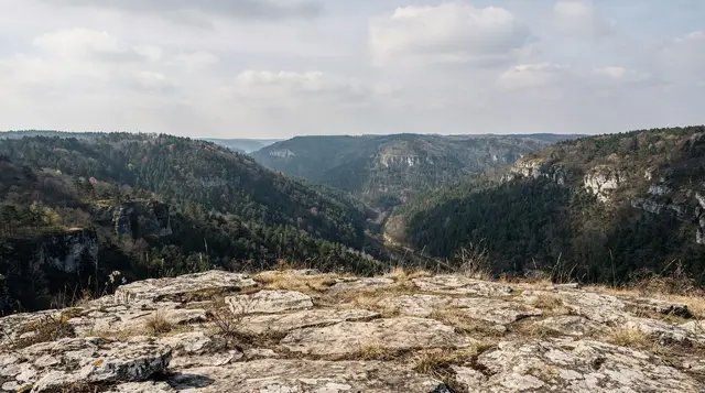
The mountain that hosted the men’s downhill
Bjelašnica rises to 2,067 m about 30 km southwest of Sarajevo, a 45-minute drive on a road that climbs out of the valley fast enough that you can watch the city shrink behind you. From 8 to 19 February 1984, its slopes carried the men’s alpine skiing events of the Winter Olympics, while Jahorina hosted the women’s races on the other side of the valley. Both mountains still carry that history in their infrastructure, but not in equal measure, and that difference is the first thing worth knowing before you plan a day here.
Bjelašnica sits in the Federation of Bosnia and Herzegovina, and its Olympic-era lift network never received the sustained reinvestment that Jahorina’s did on the Republika Srpska side after the war. Some of the original 1984 lift lines on Bjelašnica are still running in upgraded form; others stand disused, their pylons visible from the ridge as you walk or ski past. This isn’t a hidden flaw to discover on arrival — it’s the honest state of the mountain, and it shapes what kind of day you should expect.
Getting there from Sarajevo
The drive from central Sarajevo to the Babin Do base area on Bjelašnica takes about 45 minutes on a paved road through Ilidža, climbing steadily once you leave the Miljacka valley. There’s no direct public transport line running the full route in winter with any reliability — most visitors go by rental car, organised transfer, or a guided tour that includes the drive. In summer, the road is straightforward for a hire car; in winter, snow tyres or chains are worth checking before you set off, and conditions above the treeline can change faster than the forecast suggests.
A number of operators run the mountain as a day trip out of the city, which removes the question of winter driving entirely. A full-day tour covering Bjelašnica, Igman and Umoljani is the most efficient way to see the Olympic mountain plateau and a stone-built village in a single outing without renting a car.
Skiing today: the honest picture
Bjelašnica’s ski area sits around the Babin Do base station, with pistes running down from close to the 2,067 m summit. Snow reliability is generally good from late December into March given the altitude, and on a clear day the run down offers a long, open view over the ridgelines toward Igman and, further off, the Sarajevo valley itself.
The catch is the lift network. Part of what was built for 1984 has been renovated or replaced over the past two decades; part of it has not, and stands as rusted chairlift towers and closed base buildings that are now almost as photographed as the working pistes. Queue times can be longer than the terrain would suggest simply because fewer lifts are operating than the map implies, and grooming is less consistent than at better-funded resorts. None of this makes Bjelašnica a bad day out — the skiing is real and the mountain is beautiful — but it does mean this isn’t the mountain to choose if modern lift infrastructure and guaranteed grooming are what you’re after.
| Bjelašnica | Jahorina | |
|---|---|---|
| Summit altitude | 2,067 m | 1,916 m |
| 1984 Olympic event | Men’s alpine skiing | Women’s alpine skiing |
| Lift infrastructure | Partly original, partly renovated; some lines abandoned | More extensively modernised |
| Entity | Federation of Bosnia and Herzegovina | Republika Srpska |
| Distance from Sarajevo | 30 km / 45 min | 30 km / 45 min |
| Reputation among locals | Better views, rougher edges | More reliable skiing |
For skiers weighing the two mountains against each other, a side-by-side comparison of lift passes, terrain and reliability is covered in full on the Jahorina versus Bjelašnica guide. General planning — passes, rental, lessons — sits on the skiing near Sarajevo guide, the Bjelašnica ski guide, the ski passes and prices page, and the rental and lessons guide. If you’re arriving without winter gear, the Sarajevo winter packing guide is worth a read before you go.
Hiking and the summer plateau
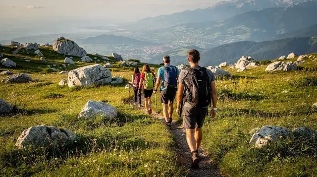
Outside the ski season, Bjelašnica becomes a hiking mountain, and arguably a more rewarding one than in winter. The road and marked trails up to the summit ridge are open from roughly June to September, and the walk rewards you with an unbroken view down over the Sarajevo valley on a clear day — the city laid out in the Miljacka gorge with the surrounding ridgelines closing around it, which does a better job of explaining Sarajevo’s geography than any map.
The plateau below the summit, around Babin Do and stretching toward the high pastures, is used for grazing in summer and has a genuinely alpine feel that’s unusual this far south in the Balkans. It’s also the practical gateway to two of the most distinctive places near Sarajevo: the stone-roofed village of Lukomir, the highest inhabited settlement in the country at around 1,469 m, and Umoljani, a smaller village at the edge of the Rakitnica canyon.
Both deserve their own visit and their own page — the Lukomir hike guide, the Bjelašnica and Umoljani day trip guide, and the Rakitnica canyon trek guide cover them properly. This page is about the mountain itself, not those villages, so treat Bjelašnica as the first half of a longer day rather than the whole of it if Lukomir is on your list.
A guided option that links Bjelašnica directly to Lukomir without you needing your own transport is the guided hiking day from Sarajevo to Lukomir village, which crosses the plateau on foot with a local guide rather than driving the access road. For something faster and less strenuous, the quad bike route from Bjelašnica to Lukomir covers similar ground on wheels, which suits visitors short on time or without hiking experience.
Staying on marked trails
Bosnia and Herzegovina still has suspected minefields left from the 1992–1995 war, concentrated in rural and mountain areas away from towns and maintained paths — the landmine safety guide explains the rules in full, and they apply here as much as anywhere in the Olympic mountains.
On Bjelašnica specifically: stay on the marked trails and the areas around the ski infrastructure and access roads, respect any yellow or red warning signs without exception, and take a guide if you want to explore beyond the well-used routes toward the summit or across to Umoljani. This isn’t a reason to avoid the mountain — thousands of people hike and ski here safely every year — but it is a rule with no exceptions, and locals will tell you the same thing without being asked.
The 1984 legacy up close
Walking or skiing Bjelašnica today means passing directly through Olympic history rather than reading about it in a museum. The men’s downhill and giant slalom courses ran down slopes still skied today, and several original structures — start huts, parts of the old lift lines, sections of piste marking — remain visible if you know roughly where to look, alongside the newer replacements.
It’s a quieter, more weathered counterpart to the abandoned bobsleigh track on Trebević, which sits much closer to the city and is now covered in graffiti and freely accessible. For the fuller story of how the 1984 Games shaped Sarajevo and what happened to their venues afterwards, including Bjelašnica’s, the 1984 Olympics legacy guide covers all four host mountains together.
Visitors with a specific interest in that period, and in the region’s more recent history generally, sometimes pair a Bjelašnica day with a guided overview of the country’s twentieth century — the Rise and Fall of Yugoslavia tour covers Sarajevo’s Yugoslav-era sites in the city itself and is a natural complement rather than a substitute for the mountain visit.
Practical details
| Item | Detail |
|---|---|
| Distance from Sarajevo | 30 km, about 45 minutes by car |
| Summit altitude | 2,067 m |
| Base area | Babin Do |
| Ski season | Mid-December to March, snow dependent |
| Hiking season | June to September |
| Lift pass (day, high season) | Roughly 40–60 KM (≈20–31 EUR) |
| Equipment rental | Available at Babin Do; book ahead in peak weeks |
| Food on the mountain | A handful of restaurants and huts at Babin Do; cash preferred |
| Mobile signal | Reliable at the base, patchy toward the summit ridge |
Prices at Babin Do and nearby villages run in cash more often than not — the same rule that applies across rural Bosnia and Herzegovina holds here, so carry KM rather than relying on cards once you’re off the main road. If you’re combining the mountain with a night away from Sarajevo, mountain huts in the wider Bjelašnica–Igman area offer simple, inexpensive beds, though most visitors treat Bjelašnica as a day trip and return to the city by evening.
For visitors without a car and not wanting a fixed group tour, the day trips without a car guide lays out transfer and taxi options, and the car rental guide covers hiring your own for a more flexible route across Bjelašnica, Igman and the villages beyond. A broader look at what else counts as a realistic day trip from the city, with honest distances and durations, sits on the best day trips from Sarajevo guide.
Bjelašnica or Jahorina, if you only have one day
If skiing quality is your main criterion and you only have one mountain day in Sarajevo, Jahorina is the more dependable choice for pistes and lifts. If you want the Olympic story told in full — including its unfinished chapter — plus a summer hike with the best panorama over the Sarajevo valley and easy onward access to Lukomir and the Rakitnica canyon, Bjelašnica earns the trip on its own terms. Many visitors end up doing both across a longer stay, which the Jahorina versus Bjelašnica comparison and the wider hiking around Sarajevo guide can help plan.
Bjelašnica: frequently asked questions
How do I get to Bjelašnica from Sarajevo without a car?
The most reliable option is an organised transfer or guided tour, since there is no dedicated public transport line running the full 30 km route with consistent service, especially in winter. Taxis will make the trip on request but at a negotiated fare rather than a metered one for a round day.
Are the ski lifts on Bjelašnica reliable?
Some are modern and well maintained; others date to 1984 and have not been renovated, and a portion of the original network is no longer operating at all. Expect fewer running lifts than the trail map suggests and plan for longer queues than at a fully modernised resort like Jahorina.
Is Bjelašnica or Jahorina better for skiing?
Jahorina generally has more reliable snowmaking and a more modernised lift network, making it the steadier choice if ski quality is your priority. Bjelašnica has the higher summit and, for many visitors, the more striking view over the Sarajevo valley.
Can I hike to the Bjelašnica summit in summer?
Yes, from roughly June to September, using the marked road and trails from the Babin Do base area. Stay on marked routes throughout — parts of rural Bosnia and Herzegovina, including areas around this range, still have suspected landmines away from maintained paths.
Does Bjelašnica connect to Lukomir village?
Yes, Bjelašnica’s plateau is the usual access route toward Lukomir, the highest inhabited village in the country, and toward Umoljani and the Rakitnica canyon nearby. This page covers the mountain itself; the villages have their own dedicated guides.
What’s left from the 1984 Winter Olympics on Bjelašnica?
Sections of the original alpine skiing courses are still in use, and parts of the 1984-era lift infrastructure remain visible alongside newer replacements, some renovated and some left as they are. It’s a quieter counterpart to the more famous abandoned bobsleigh track on Trebević, closer to the city.
Do I need a guide to visit Bjelašnica?
No guide is required for the ski area or the marked summit trail, but a guide is strongly advised for any route beyond those, including toward Umoljani or into the Rakitnica canyon, both for navigation and for landmine safety in less-travelled terrain.
What should I pack for a winter day on Bjelašnica?
Layered winter clothing, waterproof boots, and cash in KM for lift passes and food at Babin Do, since card acceptance thins out once you leave central Sarajevo. A full packing rundown is on the dedicated winter packing guide.