Jahorina hosted the women’s alpine skiing at the 1984 Winter Olympics, and more than forty years on it is still the mountain Sarajevo skis on. It sits 30km southeast of the city, about 45 minutes by car, and it is now Bosnia and Herzegovina’s largest and best-equipped ski resort by a clear margin. In summer the same slopes strip back to grass and forest, and the lifts keep running for hikers and mountain bikers who want the view without the climb.
Where Jahorina sits, and why the plates change
Jahorina rises on the Republika Srpska side of the boundary line that splits Bosnia and Herzegovina into two entities. You will notice it as soon as you leave the Federation: road signs shift from the Latin alphabet to Cyrillic, car number plates change format, and the flags flying over hotels and lift stations are different from the ones in central Sarajevo. None of this affects a visitor practically - the currency, the language, and the road rules are the same, and no border crossing or paperwork is involved. It is simply a fact of the country’s postwar structure, visible on a 45-minute drive, worth noting without reading anything more into it.
The mountain takes its name from the beech forests (jahor) that once covered its lower slopes, and it belongs to the same range as Bjelasnica and Igman, the trio that carried the 1984 Winter Olympics. Where Bjelasnica hosted the men’s downhill and Igman the ski jumps and cross-country, Jahorina was the women’s alpine venue, and it is the one that grew fastest afterwards.
Skiing: the best-equipped mountain near Sarajevo
This is the practical reason most people go. Jahorina’s ski area is larger, its lift network denser, and its slopeside infrastructure newer than anything at Bjelasnica. There are more pistes, more chairlifts and drag lifts in parallel, more ski schools, more equipment-rental counters, and a bigger spread of hotels and apartments built directly at the base and partway up the mountain. If you are choosing between the two Olympic mountains for a winter base rather than a day trip, Jahorina is the one built for staying several nights; Bjelasnica is smaller and quieter, with fewer beds and a shorter lift queue. Neither is wrong - it depends on whether you want infrastructure or space.
Runs cover a range of levels, from gentle nursery slopes near the base to longer red and black pistes higher up, and the summit area around Ogorjelica opens onto wide, mostly treeless bowls that hold snow well into March in a normal winter.
Day lift passes and equipment rental are priced and posted at the resort itself and change from one season to the next; treat any figure you read as approximate and check the board at the ticket office or the resort’s current pricing before you commit, particularly around the Christmas and New Year peak when demand pushes prices up. As a rough planning figure, a full ski day including a lift pass, rental, and lunch on the mountain runs somewhere in the 60-100 KM (about 30-51 EUR) range per person, though a lift pass alone in low season can come in well under that.
Ski schools operate in several languages and can be booked on arrival or a day ahead in busier weeks; equipment rental shops cluster around the main base station and the hotel strip, and prices are broadly comparable between them, so there is little reason to pre-book unless you are travelling over a holiday weekend.
Getting there and around
A car is the easiest way, and the drive from central Sarajevo takes about 45 minutes on a paved road that climbs steadily through Pale. In winter the road is treated but can be icy at altitude; winter tyres or chains are a sensible precaution, and they are a legal requirement in the season regardless. Organised transfer minibuses run from Sarajevo on ski days in season, aimed mainly at day-trippers who do not want to drive; ask at your accommodation, since routes and pickup points shift year to year. There is no rail option and no scheduled public bus timetable reliable enough to plan a day trip around, so budget for a taxi, transfer, or rental car.
Once on the mountain, the base area, mid-mountain hotels, and lift stations are connected by short walking paths and shuttle runs in the busiest weeks; most visitors simply base themselves near one lift and stay there for the day.
Summer on Jahorina: hiking and biking without the crowds
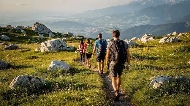
Jahorina’s image outside winter is thin, which is exactly why it is worth correcting. From June to September the pistes become open hiking terrain and the lift network - or at least a working chairlift - typically continues operating on weekends and through the height of summer, carrying walkers and mountain bikers up without the climb. The paths that thread between the ski runs connect into longer routes across the wider Bjelasnica-Igman upland, and several of them link toward Umoljani and the stone village of Lukomir on the far side of the range, though that is a proper day’s hike rather than an afternoon stroll from Jahorina itself.
Mountain biking has grown alongside the hiking; the graded ski pistes make natural descent tracks once the snow is gone, and a handful of operators rent bikes at the base in season. None of this requires technical experience - the terrain around the lift stations is rolling and open, well short of anything alpine - but the same rule that applies everywhere in this mountain range applies here too: stay on marked paths and tracks.
Parts of Bosnia and Herzegovina, including some rural and forested areas away from cleared and frequented routes, still carry landmine risk left over from the 1990s war. On Jahorina’s managed ski and hiking terrain this is not a live concern, but it is why guides and locals alike are firm about not wandering off-piste into unmarked forest, here or anywhere similar in the country.
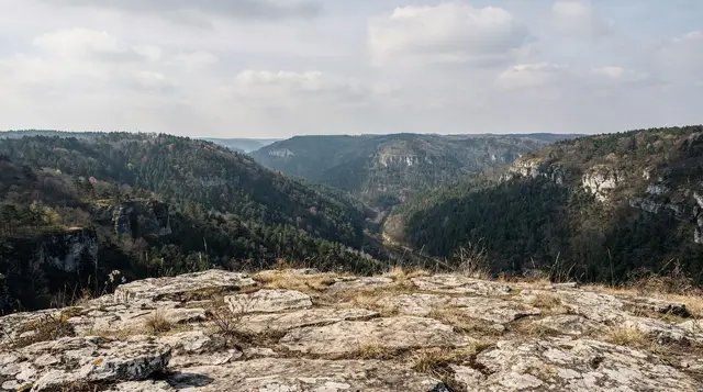
The summit area, Ogorjelica at 1,916m, gives a wide panorama back toward Sarajevo’s valley and out across the Republika Srpska hills to the southeast, and it is a genuinely different view from anything the city itself offers.
Jahorina or Bjelasnica: which one to choose
Both mountains are close to Sarajevo, both carried 1984 Olympic events, and both work as a half-day or full-day trip. The honest difference is infrastructure and character.
| Jahorina | Bjelasnica | |
|---|---|---|
| Distance from Sarajevo | 30km, ~45 min | 30km, ~45 min |
| Olympic role, 1984 | Women’s alpine skiing | Men’s alpine skiing |
| Ski area size | Bosnia’s largest resort | Smaller, quieter |
| Lift network | Dense, multiple base areas | Fewer lifts, shorter queues rare regardless |
| Accommodation | Extensive, slopeside hotels and apartments | Limited, fewer beds |
| Entity | Republika Srpska | Federation of Bosnia and Herzegovina |
| Summer draw | Hiking, biking on cleared pistes | Hiking, links toward Lukomir |
| Best for | Skiers wanting facilities and choice | Visitors wanting quieter slopes and mountain villages nearby |
If skiing is the priority and you want a wider choice of runs, rental shops, and places to eat and stay, Jahorina is the stronger pick. If you would rather combine a shorter mountain visit with the stone-house villages of the wider Bjelasnica upland, Bjelasnica and a hike toward Lukomir suit that better. Several visitors do both on separate days, since neither trip from Sarajevo takes more than an hour each way.
Eating on the mountain
Restaurants cluster at the base and at mid-mountain stations, mostly serving grilled meat, thick stews, and the same Bosnian staples found in Sarajevo - cevapi, grilled trout, bean stew - at prices a little above the city but well short of anything resembling a resort mark-up you would meet in the Alps. A hot meal with a drink runs roughly 15-25 KM. Coffee stops at the base and near the main chairlifts serve the same bosanska kafa found across the country.
Planning a Jahorina day from Sarajevo
A ski day works best started early: leave Sarajevo by 8am to be on the first lifts, allow the 45-minute drive plus time to collect rental gear, and plan to leave the mountain by mid-afternoon to avoid driving the Pale road after dark in winter. A summer hiking or biking day has more flexibility, since the terrain is gentler and the light lasts longer, but the same road applies both ways.
Pack for temperature swings either season: winter cold at altitude is sharper than in the Sarajevo valley, and even a summer visit can turn cool and windy on the exposed summit ridge near Ogorjelica. For context on how Jahorina fits into a longer stay, see skiing near Sarajevo and the wider hiking around Sarajevo guide, or read how the 1984 Games shaped this whole range in Sarajevo’s 1984 Olympics legacy.
Travellers weighing a guided option over driving themselves can join a guided walk through the wider Olympic Mountains: on the Highlands Path guided hike with lunch a local guide leads the walking and takes care of transport and a mountain meal, which removes the need to rent a car for a single day out. Those wanting to see how these mountains connect to Sarajevo’s wartime history can pair a trip with the Rise and Fall of Yugoslavia tour, which covers the broader context behind the 1984 Games and what followed.
For a longer day into the stone village beyond this range, the guided hiking tour to Lukomir village or the Lukomir hike with picnic lunch both start from Sarajevo and cover ground adjoining Jahorina’s summer trail network.
For a wider look at the city itself before or after a mountain day, see Sarajevo in one day or the fuller Sarajevo in three days itinerary, and check best time to visit Sarajevo for how the mountain season lines up with the city’s own weather.
Jahorina: frequently asked questions
How far is Jahorina from Sarajevo?
About 30km, which takes roughly 45 minutes to drive on a paved mountain road through Pale. There is no train service, and public bus timetables are not reliable enough to plan a day trip around, so most visitors drive, take an organised ski-season transfer, or hire a taxi.
Is Jahorina bigger than Bjelasnica?
Yes. Jahorina is Bosnia and Herzegovina’s largest ski resort, with more lifts, more pistes, and considerably more slopeside hotels and apartments than Bjelasnica, which is smaller and quieter with fewer beds.
Can you visit Jahorina in summer?
Yes, and it is worth it. From June to September the ski pistes become hiking and mountain-biking terrain, a chairlift typically continues running on weekends and through peak summer, and the summit at Ogorjelica gives wide views without a long climb.
How much does a ski day on Jahorina cost?
Prices change by season and are posted at the resort, so treat this as a rough guide: a full day including lift pass, equipment rental, and lunch on the mountain runs approximately 60-100 KM (about 30-51 EUR) per person, more over the Christmas and New Year peak.
Is Jahorina in Sarajevo or in Republika Srpska?
Jahorina sits within Republika Srpska, one of Bosnia and Herzegovina’s two entities, while Sarajevo itself is mostly in the Federation of Bosnia and Herzegovina. The 45-minute drive between them involves no border crossing; you will simply notice road signs and number plates change from Latin to Cyrillic.
What is the highest point on Jahorina?
Ogorjelica, at 1,916m, is Jahorina’s summit and the highest point on the ski area, reachable by lift in winter and by a combination of lift and short walking trail in summer.
Do I need a car to visit Jahorina?
A car is by far the easiest option and gives full flexibility on timing. In ski season, organised transfer minibuses run from Sarajevo on ski days and are worth asking about at your accommodation; outside those transfers, a taxi or rental car is the practical choice.
Is it safe to hike off the marked trails on Jahorina?
No - stay on marked paths and cleared ski terrain. Parts of Bosnia and Herzegovina still carry landmine risk from the 1990s war in rural and forested areas away from managed routes, and guides are firm about not leaving marked trails anywhere in this mountain range.