Umoljani: the practical base on the Bjelašnica plateau
Umoljani gets confused with Lukomir more often than it should. They sit on the same high plateau below Bjelašnica, about half an hour’s walk apart on the marked path, but they are not interchangeable as a base.
Umoljani is a working village on a road that stays open through most of the year; Lukomir, at around 1,469 m, is the highest permanently inhabited settlement in Bosnia and Herzegovina, reached by an unpaved track that snow closes for weeks at a time. If the question is where to base a trip to the highlands - especially outside the short summer window - Umoljani is usually the honest answer, and this page treats it as a destination in its own right rather than a lay-by on the road to somewhere else.
The village stone houses, meadow enclosures and grazing sheep are working infrastructure, not a stage set. People here farm through the summer and many close up and move down to Sarajevo or the Federation lowlands in the coldest months, which is worth remembering if a guesthouse or restaurant looks shut when a map suggests it should be open.
Umoljani or Lukomir: which one to base in
The two villages get lumped together in itineraries, but the differences matter for planning, particularly by season.
| Umoljani | Lukomir | |
|---|---|---|
| Distance from Sarajevo | About 40 km, roughly 1 hour | About 50 km, up to 1 hour 30 on the unpaved final section |
| Road | Paved for most of the drive, gravel near the village | Largely unpaved, rougher and narrower |
| Winter access | Usually passable with care; some closures after heavy snow | Frequently cut off for weeks at a time |
| Accommodation | Several rural guesthouses, open most of the year | Fewer beds, mostly seasonal |
| Character | Working village, meadows, easier day-trip logistics | Highest inhabited village in the country, starker, fewer visitors |
For a summer trip with time to spare, walking or driving to both in one day is realistic - see our Lukomir hike guide for the route between them. For a winter visit, or for anyone without a 4x4 or a guide, Umoljani is the more reliable choice, and a Bjelašnica and Umoljani day trip from Sarajevo covers the ground without depending on Lukomir being reachable at all.
Getting there from Sarajevo
The drive covers roughly 40 km and takes about an hour in normal conditions, following the road up through Ilidža towards the Bjelašnica ski area before branching onto the plateau road towards the village. The last few kilometres are gravel and can be slow after rain, but the route does not require a 4x4 in summer. Public transport does not reach Umoljani in any practical way, so this is a trip by rental car, taxi or organised tour; see car rental in Sarajevo and driving in Bosnia before setting out, and check current road conditions if travelling between November and April.
For visitors who would rather not drive the mountain roads themselves, a guided option covers the same ground with local knowledge of where the track is passable that week. The day tour through Igman and Bjelašnica to Umoljani takes in the village along with the wider plateau, which is a reasonable way to see the area without weighing up road conditions on the day.
What’s in the village
Umoljani is small: a scatter of stone-and-shingle houses, hay meadows, a handful of guesthouses and mountain restaurants, and the start of several waymarked paths. There is no single monument to tick off; the point of stopping here is the landscape and the pace, plus a base of operations for walks that go further. A short loop from the car park through the village and out to the nearest meadow viewpoint takes under an hour and gives a fair sense of the place even for visitors on a tight schedule.
Locals keep sheep and make cheese through the summer, and both show up on the table at the village restaurants - see the food section below. Outside the June-to-September season, expect several of the guesthouses and eateries to be closed or running reduced hours, since the resident population itself shrinks once the grazing season ends.
Short hikes to the Rakitnica canyon viewpoints
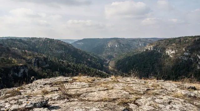
The main reason to linger in Umoljani rather than just passing through is the walking. A waymarked path leads from the edge of the village to a series of viewpoints over the Rakitnica canyon, one of the deepest and least developed gorges in the country, cut into the plateau below Visočica mountain. The nearest viewpoint is around 45 minutes on foot from the village on a clear path with a gentle climb; further viewpoints add another hour or two depending on how far along the rim a visitor wants to go. None of this requires technical hiking experience, but proper boots and water are worth carrying regardless of how short the walk looks on a map.
For a longer day, the path continues down into the gorge itself towards a suspension bridge and on to routes used by more serious trekkers; our Rakitnica canyon trek guide covers that fuller route in detail, and general orientation for the wider hiking network sits in hiking around Sarajevo. Visitors who would rather not navigate the canyon paths alone can book the guided highlands walk that includes a mountain lunch, which takes in a canyon viewpoint and finishes with a proper meal rather than a packed sandwich.
One reminder that applies to every path in this section of the plateau: stay on the marked trail. Bosnia and Herzegovina still has suspected minefields in rural and mountain areas away from cleared paths, and the Rakitnica canyon area is remote enough that help is not close by. Never cut across open ground to shortcut a viewpoint or a photo, follow any yellow or red warning markers, and take a guide for routes beyond the signed network - see landmine safety for hiking in Bosnia before setting out.
Walking on to Lukomir
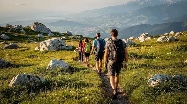
The path from Umoljani to Lukomir is one of the more popular short treks on the plateau, roughly two to three hours each way across open highland with the Rakitnica canyon visible for much of the route. It is well used in summer and reasonably easy to follow, though there is no shelter or supply point along the way, so water, sun protection and a map or GPS track matter more than the modest distance suggests.
Because Umoljani sits lower and closer to the paved road, it works well as the start or end point of a Lukomir day: park in Umoljani, walk the ridge path to Lukomir for lunch, and either walk back or arrange a pickup if a guide or tour has driven the longer way round. The guided hiking tour from Sarajevo to Lukomir village and the longer Lukomir village and Obalj peak hiking tour both use this kind of routing, with a guide who knows which sections of track are open that week. Full route notes are in the Lukomir hike guide.
Where to eat and stay
Umoljani’s mountain restaurants serve the same short list of dishes as elsewhere on the plateau, but the lamb and cheese here are usually local rather than trucked up from Sarajevo. Roast lamb (janjetina), often cooked slowly under a metal lid, and fresh sheep’s cheese with cream (kajmak) are the dishes worth ordering; a full meal with a drink typically runs to 15-25 KM per person, noticeably less than an equivalent meal in central Sarajevo. Most places are seasonal and cash-only, so carry KM rather than assuming a card machine will be working.
Guesthouses in the village range from simple rooms in a family home to slightly more polished rural lodges, generally 30-50 KM per person including breakfast. Booking ahead matters in July and August and around any local event; outside the main season, calling ahead is sensible since not every guesthouse keeps regular hours. Staying overnight in Umoljani rather than day-tripping from Sarajevo makes an early start on the Lukomir path realistic, and puts a sunrise or sunset over the canyon within easy reach without a predawn drive from the city.
When to visit
Late May through September is the reliable window: the road is clear, the guesthouses and restaurants are open, and the paths to the canyon viewpoints and to Lukomir are walkable without special equipment. July and August bring the most visitors and the fullest meadows of grazing sheep, but also the busiest parking near the trailhead on weekends.
Winter is where Umoljani’s advantage over Lukomir is clearest: the village itself usually stays reachable with care even when Lukomir’s track is closed by snow, which makes it a realistic destination for a winter day trip from Sarajevo when the higher village is not an option. That said, “usually passable” is not a guarantee - check conditions before driving up between November and April, and be ready to turn back if the gravel section is iced or drifted.
Practicalities
| Detail | |
|---|---|
| Distance from Sarajevo | About 40 km |
| Drive time | About 1 hour, longer after snow or heavy rain |
| Entry cost | None; parking is informal and usually free |
| Mobile signal | Patchy; do not rely on it for navigation |
| Cash | Essential - most guesthouses and restaurants do not take cards |
| Nearest fuel | Ilidža or the Bjelašnica road; none in the village itself |
Questions about visiting Umoljani
Do I need a 4x4 to reach Umoljani?
No. The road is paved for most of the way from Sarajevo, with a gravel final stretch that a normal car can handle in dry conditions. A 4x4 becomes useful only after snow or heavy rain, and even then it is often the difference between comfortable and uncomfortable rather than possible and impossible.
Is Umoljani the same place as Lukomir?
No, though they are often mentioned together. Umoljani is a lower, more accessible village reached by a road that stays open most of the year; Lukomir is the highest inhabited village in Bosnia and Herzegovina, further along the plateau on a track that closes for weeks at a time in winter. Umoljani is the practical base for reaching Lukomir, not a substitute for it.
Can I walk from Umoljani to Lukomir in a day?
Yes. The marked path takes roughly two to three hours each way across open highland, with the Rakitnica canyon visible along much of the route. Carry water and sun protection, since there is no shade or facilities on the way, and confirm the return arrangement before setting out if relying on a guide or transfer.
What is there to see right in Umoljani village itself?
Stone houses, hay meadows and grazing sheep rather than a single sight to tick off. The value of Umoljani is as a base and a starting point: short walks to viewpoints over the Rakitnica canyon begin at the edge of the village, and the village restaurants serve some of the best lamb and cheese on the plateau.
Is Umoljani open and accessible in winter?
Usually, with more reliability than Lukomir, though not guaranteed. The road can still ice over or drift shut after heavy snow, and a number of guesthouses and restaurants reduce their hours or close outside the summer grazing season. Check conditions before driving up between November and April.
Are there landmines near Umoljani or the Rakitnica canyon?
Bosnia and Herzegovina still has suspected minefields in remote rural and mountain areas, and this plateau is no exception. The rule is simple: stay on marked paths, respect any yellow or red warning markers, and take a guide for routes beyond the signed network, particularly around the canyon rim and any approach to Lukomir off the main trail.
Do I need to book a guide, or can I do this independently?
Independent visits are straightforward for the village itself and the nearest canyon viewpoint, which sit on a clear, short, waymarked path. For the longer walk to Lukomir or any route into the canyon itself, a guide adds real value - both for navigation and for staying reliably on cleared ground. Tours such as the Lukomir village and Obalj peak hiking tour cover the longer routes with someone who knows the current trail conditions.