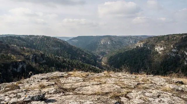
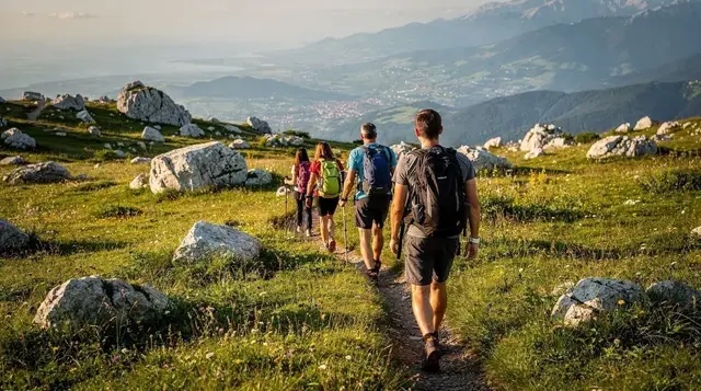
A canyon between two mountains
Rakitnica Canyon cuts through the high Bjelašnica–Visočica plateau, a deep gash in the limestone that separates the two massifs south of Sarajevo. The river Rakitnica runs at the bottom, and the walls above it rise steeply enough that the canyon reaches depths of several hundred metres in its lower reaches. It is one of the least visited landscapes this close to a European capital, and that is precisely the point: no ski lift, no paved road, no signal for most of the walk.
This page covers the canyon itself — the trails, the difficulty, the conditions you need to plan around. It does not cover where to sleep or eat in the villages that serve as trailheads; for that, see the separate pages on Umoljani and Lukomir, which sit on the rim above and function as the gateway settlements. Treat this page as the walk, and those two as the base camp.
Where it sits and how you get there
The canyon runs roughly between the villages of Umoljani on the Bjelašnica side and Lukomir, Bosnia and Herzegovina’s highest permanently inhabited village, on the Visočica side. Both villages are trailheads; neither is the canyon.
From Sarajevo, it is about 50 km to Umoljani and 55 km to Lukomir, both roughly 1h15 to 1h30 by car — the last stretch is an unpaved mountain track that a normal city car can usually manage in dry summer conditions but that turns to mud fast after rain. There is no public transport that reaches either village on a schedule useful for a day hike; most visitors arrive by rental car, organised transfer, or as part of a guided trip. For the driving basics and what the road actually looks like once you leave the asphalt, see the guide to driving in Bosnia and car rental in Sarajevo.
If you would rather not drive the unpaved section yourself, the most straightforward option is a guided hike that includes transport. A guided hike to Lukomir from Sarajevo handles the road, the pace, and the route-finding, and it is built around exactly this landscape.
What the walk actually involves
“Rakitnica Canyon” is not a single marked trail with a start and end sign. It is a general term for several route options that approach, skirt, or descend into the canyon from the two rim villages. Difficulty varies a great deal between them, and this is the single most important thing to understand before committing a day to it.
| Route | Trailhead | Distance | Time | Difficulty |
|---|---|---|---|---|
| Rim viewpoint walk | Umoljani | 8–10 km round trip | 3–4 hours | Moderate — well-trodden near the village, rougher near the rim |
| Canyon floor descent and return | Umoljani or Lukomir | 12–16 km round trip | 6–8 hours | Strenuous — steep descent, loose scree, a river crossing |
| Full traverse, Umoljani to Lukomir via the canyon | Umoljani, finishing Lukomir | 18–22 km one way | 8–9 hours | Technical — exposed sections, unmarked stretches, requires a guide |
The rim viewpoint walk is the one realistic option for a fit but inexperienced hiker without a guide, and even that benefits from local knowledge, since the path splits more than once with no signage to say which fork goes where. The descent into the canyon floor and the full traverse are a different category of walk: steep loose ground on the way down, a cold river crossing that can be knee-deep or waist-deep depending on rainfall and snowmelt, and stretches where the path is a line of cairns rather than a marked trail. None of this is dangerous if you know the ground. All of it is dangerous if you do not.
For a walk-by-walk breakdown of the technical sections, gear list, and turn-by-turn notes, see the dedicated Rakitnica canyon trek guide. This page stays at the level of what to expect and how to decide.
The honest warning
Say this plainly: Rakitnica is a remote, sparsely walked canyon with trails that are often poorly marked, and a solo attempt on the canyon floor routes without local knowledge is a genuine risk, not a dramatic exaggeration. People do get lost here, the terrain does not forgive a wrong turn on scree, and mobile signal disappears for long stretches once you drop below the rim. A guide is not a nice-to-have for the descent and traverse routes — it is the difference between a hard, memorable day and a search-and-rescue call in a valley where rescue takes hours to arrive.
There is a second, non-negotiable reason to stay on known paths anywhere in Bosnia and Herzegovina’s rural mountains: unexploded landmines remain suspected across parts of the countryside, including areas of the Bjelašnica and Visočica highlands, decades after the war.
The rule is absolute and it applies here as much as anywhere in the country — never leave marked trails and frequented paths, respect any yellow or red warning signage without exception, and do not improvise a shortcut across open ground, however inviting it looks. A local guide knows which ground has been cleared and which has not; a map app does not. Read the landmine safety guide for hiking in Bosnia before you go, whether or not you plan to hike with a guide.
None of this means the canyon is unwelcoming to visitors — thousands of hikers walk sections of it safely every summer. It means the margin for improvisation is small, and the sensible response is a guide, known trails, and good information rather than caution that keeps you away entirely.
Guided or independent
For the rim viewpoint walk from Umoljani, a fit hiker with a downloaded offline map and a clear morning can reasonably go alone, provided they turn back at the first sign of a route that stops feeling obvious. For the descent, the river crossing, or the full traverse to Lukomir, go with a guide. Local guides based around Umoljani and Lukomir know the current state of the river crossing, which changes with the season, and which of the unmarked stretches are currently cairned and which have drifted.
A guided hike to Lukomir from Sarajevo covers the approach and the village side of this landscape with a guide who knows the ground, and is the most practical way to see the canyon rim without arranging your own transport and route-finding. If your interest in Bosnia’s mountains runs more toward guided wilderness days than technical trekking, the same instinct applies further afield — a guided jeep trip to see the wild horses near Livno is a different region entirely but the same principle: local knowledge over improvisation once you are off asphalt.
If Sarajevo’s old town is still on your list before you head into the mountains, a guided walking tour of Sarajevo is a sensible way to spend the day before or after, since a canyon day starts early and finishes tired.
What to bring
Sturdy hiking boots with ankle support, not trainers — the descent routes are loose underfoot and a rolled ankle two hours from the nearest road is a serious problem. Trekking poles help on the steep sections. Bring more water than you think you need; there are natural sources along some routes but treat or filter before drinking.
A paper map or a downloaded offline map is worth carrying even with a guide, since phone signal is unreliable below the rim. Layers matter even in summer — the plateau sits above 1,400 metres and mornings are cold even when Sarajevo is warm in the valley. For the technical descent and traverse routes, some operators provide via ferrata style aids on the steepest scrambles; ask your guide in advance rather than assuming.
For broader context on what to pack for the mountains around Sarajevo across seasons, see the winter packing guide — most of its layering logic applies to cold mountain mornings in any season, not only winter.
Season and conditions
June through September is the realistic window. Snow can linger into May at this altitude, and the river crossing runs higher and colder with spring snowmelt, which makes an already technical section genuinely dangerous outside summer. By October, days shorten fast enough that starting the canyon floor routes becomes a timing risk — you do not want to be finishing a descent as light fails. If you are set on the shoulder seasons, stick to the rim viewpoint walk from Umoljani and skip the canyon floor entirely.
Weather changes quickly at this altitude even in summer; a clear morning can turn to afternoon cloud and a sudden temperature drop on the exposed sections of the rim. Check the forecast the morning of, not the night before, and be willing to turn a canyon floor attempt into a rim walk if conditions look uncertain.
Combining it with the wider plateau
Rakitnica sits at the centre of a wider walking landscape that includes Bjelašnica, Igman, and the approach to Lukomir and Umoljani themselves. Most visitors base a full day around one canyon route plus a walk through whichever village they started or finished in — Lukomir’s stone houses and shingled roofs, or Umoljani’s quieter, less-visited version of the same highland life.
Neither village is covered in detail here; both have their own pages, and the Lukomir hike guide and coverage of a Bjelašnica and Umoljani day trip are the right next stops if you want accommodation, village detail, or a shorter version of the day.
If a single canyon day is not enough and you want to build hiking around it into a longer stay, the nature-focused week itinerary strings Rakitnica together with the Sutjeska and Una national parks further from Sarajevo. For a wider view of what else is walkable near the capital, the general hiking around Sarajevo guide is the index page for all of it, and best day trips from Sarajevo sets the canyon in context against Mostar, Konjic, and the rest.
Rakitnica Canyon: common questions
Do I need a guide to hike Rakitnica Canyon?
For the rim viewpoint walk from Umoljani, an experienced hiker with an offline map can manage without one. For the canyon floor descent, the river crossing, or the full traverse to Lukomir, a guide is strongly recommended — the trails are often poorly marked, mobile signal is unreliable, and the terrain does not forgive a wrong turn.
How difficult is the hike?
It depends entirely on the route. The rim viewpoint from Umoljani is a moderate 3–4 hour walk. Descending into the canyon floor and back is a strenuous 6–8 hour day with steep, loose ground and a river crossing. The full traverse from Umoljani to Lukomir is a technical 8–9 hour route with exposed and unmarked sections, and is not a beginner walk under any circumstances.
Can I visit Rakitnica Canyon as a day trip from Sarajevo?
Yes. Both trailheads are 50–55 km and roughly 1h15–1h30 from Sarajevo. The tighter constraint is the walk itself, which can run up to 9 hours for the full traverse — start early, and be realistic about which route fits the daylight and your fitness.
Are the trails marked?
Inconsistently. The approach paths near Umoljani and Lukomir are reasonably clear. Sections lower in the canyon and along the traverse are marked only by cairns, and cairns can be knocked over or drift between seasons. This is the main reason a guide matters for anything beyond the rim viewpoint walk.
Is Rakitnica Canyon affected by landmines?
Unexploded landmines remain a suspected risk across parts of rural Bosnia and Herzegovina’s mountains, including areas of the Bjelašnica and Visočica highlands. Never leave marked trails and frequented paths, and always respect warning signage. Read the landmine safety guide before setting out.
What is the best time of year to go?
June to September. Snowmelt makes the river crossing higher and colder in spring, and shorter autumn daylight makes the longer canyon floor routes risky to time correctly. Outside summer, stick to the rim viewpoint walk.
Do I need technical climbing gear?
Not for the rim walk. For the steepest sections of the descent and traverse, some guided operators use via ferrata style aids on the worst scrambles — ask in advance what your specific route requires rather than assuming standard hiking gear is enough.
Is this suitable for beginners?
The rim viewpoint walk from Umoljani is achievable for a reasonably fit beginner. The canyon floor descent and the full traverse are not beginner routes — they involve steep loose terrain, a river crossing, and route-finding on unmarked ground, and should be attempted with a guide regardless of hiking experience elsewhere.