Visočica and Obalj: hiking beyond the Olympic mountains
How hard is the Visočica hike to Obalj and Vjetrenik?
Reaching Vjetrenik (around 1,960 m) or the Obalj ridge from Boračko Lake is a 5-6 hour round trip on unmarked paths, with no huts, signage or mobile signal once you leave the lake shore. Go with daylight to spare, proper boots, and ideally a local guide.
Everyone who spends a few days in Sarajevo hears about Bjelašnica and Jahorina, the two Olympic mountains with cable cars, ski lifts and a road most of the way up. Fewer hear about Visočica, a limestone ridge above Boračko Lake near Konjic, whose highest point, Vjetrenik, reaches around 1,960 m.
There is no lift here, no marked network of huts, and no crowd at the top. It is a genuine hiking mountain, and this guide treats it as one: what the access looks like, what the two main approaches involve, what is missing in terms of infrastructure, and the one safety rule that matters more than any other in this part of Bosnia and Herzegovina.
Why Visočica, and why it isn’t on the usual list
Most day-trip lists out of Sarajevo point towards Lukomir, the highest permanently inhabited village in the country, or the ski resorts closer to the city. Visočica sits in a different direction, above Konjic, and gets left off itineraries mostly because there is nothing to photograph at the trailhead and nothing to book once you arrive. That is also its appeal: a genuinely quiet mountain, forested lower slopes giving way to open ridge, and views over Boračko Lake and the Neretva valley that most Sarajevo visitors never see. It suits walkers who want a real hike rather than a viewpoint with a car park.
The mountain takes its name from the wider Visočica range that runs south of Konjic; Vjetrenik is its principal summit, with the lower Obalj peak forming a separate, shorter target on the same massif. Both are reached from the same trailhead area at Boračko Lake, which is what makes this a genuinely flexible day: pick the shorter loop to Obalj, or commit to the longer push for Vjetrenik, depending on time and weather.
Getting to the trailhead via Konjic
Konjic is about 60 km and roughly an hour by car from Sarajevo, on the road that also carries traffic south towards Mostar. It’s worth knowing what else is in Konjic before driving straight through: the town’s Ottoman bridge, rebuilt after wartime damage and dating originally to 1682, spans the Neretva right in the centre, and a short drive out of town is the Cold War bunker built for Tito’s government — a site substantial enough to deserve its own visit rather than a rushed stop before a six-hour hike. The Konjic day trip guide and the dedicated bunker guide cover both properly; this page is about what happens once you leave the town behind.
From Konjic, the lake road runs a further 15-20 minutes to Boračko Lake, a small glacial lake ringed by forest that functions as the practical starting point for Visočica. There is a car park of sorts by the lake shore, some seasonal food stalls in summer, and rental rowing boats on the water in high season — the last conveniences you will see for the rest of the day. Public transport does not reach the lakeside trailhead directly; this is a hike that needs a car, a taxi from Konjic, or a guided tour that includes the drive. Anyone without their own vehicle should read the day trips without a car guide or look at car rental in Sarajevo before planning the day.
The route to Vjetrenik summit
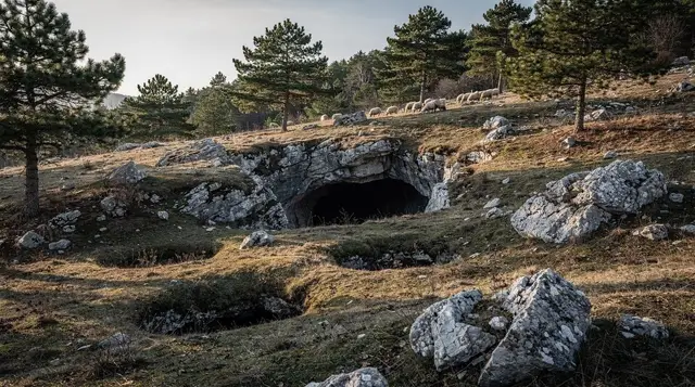
The path to Vjetrenik climbs out of the forest above Boračko Lake, gaining height steadily through beech and pine before opening onto the exposed limestone ridge that gives Visočica its character. There is no waymarking to speak of — no red-and-white circles of the kind found on better-known Bosnian mountains — so the route is really a matter of following the visible track and, ideally, a downloaded GPS trail rather than trusting signage that isn’t there. Expect around three hours up at a steady pace, longer if the ground is wet or if you stop often for the views back over the lake, and two to three hours back down: call it 5-6 hours round trip depending on fitness and how long you linger on top.
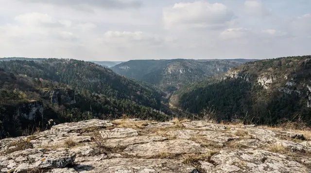
The summit itself is unremarkable in the way that honest mountain summits often are — a rocky high point with a 360-degree view rather than a monument or a café — but on a clear day the panorama takes in the Neretva valley, the wider Konjic basin, and on the best days the higher peaks further south towards Sutjeska National Park. Wind picks up noticeably once you’re above the treeline, even on a warm day at the lake, so a windproof layer is worth carrying even in summer.
The shorter route: Obalj and the Bijela Vodica spring
Obalj is the more approachable target on the same massif, reachable in a shorter loop from the lake that suits walkers who want a proper hike without committing a full day to it. The path passes Bijela Vodica, a spring on the lower slopes that is genuinely useful rather than decorative: it’s one of the only reliable water points on the mountain, and worth refilling bottles at even if you’re not short, since nothing resembling a kiosk or hut follows further up. From Bijela Vodica the path climbs more gently towards the Obalj ridge, with views opening out earlier than on the Vjetrenik route because the terrain here is lower and less forested.
A loop taking in Obalj and back to the lake can be done in three to four hours at an unhurried pace, which makes it the more realistic option for anyone combining the hike with a stop in Konjic on the same day, or for families with older children who want a taste of the mountain without the full Vjetrenik push. It’s also the sensible fallback if weather closes in partway up — the Obalj side gives better shelter and a shorter retreat than pressing on towards the higher summit.
| Target | Distance from Sarajevo | Round trip from the lake | Terrain |
|---|---|---|---|
| Boračko Lake trailhead | ~65-70 km / 1h 15-1h 20 | — | Sealed and gravel road |
| Obalj ridge | as above | 3-4 hours | Forest, then open ridge, gentler grade |
| Vjetrenik summit (~1,960 m) | as above | 5-6 hours | Forest, then exposed limestone ridge, steeper |
What isn’t here: huts, signage, phone signal
It is worth being direct about the gap between Visočica and better-resourced Bosnian mountains, because it changes how the day should be planned. There is no mountain hut to shelter in or buy a coffee at. There is no consistent waymarking beyond the visible line of the path itself. Mobile signal, reliable enough at the lake, becomes patchy to absent within the first hour of climbing and cannot be counted on for navigation, weather checks or calling for help.
None of this makes the hike dangerous for a prepared walker, but it does mean the preparation has to happen before leaving Sarajevo, not on the mountain: download an offline map or GPS track, tell someone your planned route and return time, and treat the lake as the last point where you can reliably get information or assistance.
Compare this with the infrastructure around Trebević or the cable car at Bjelašnica, and it’s clear Visočica sits at the other end of the spectrum from Sarajevo’s more visited mountains — closer in character to the routes described in the Rakitnica canyon guide or the wider hiking around Sarajevo overview, both of which cover similarly self-reliant terrain.
Walkers who prefer a mountain with a hut network and clearer waymarking should look instead at the routes in the Sarajevo mountain huts guide or the higher peaks covered in the Maglić and the high peaks guide.
The landmine rule
Bosnia and Herzegovina still has land contaminated by mines laid during the 1992-1995 war, and the areas around Konjic and the wider Herzegovina hinterland are among those still under suspicion in places away from cleared paths. The rule for Visočica, as for any unmarked hiking in this country, is simple and non-negotiable: stay on paths that are visibly used by other walkers, never cut across open meadow, forest edge or abandoned structures to shortcut a route, and respect any yellow or red hazard signage without exception.
The obvious lakeside approach to Obalj and the main line towards Vjetrenik are walked regularly enough to be considered safe when followed properly; wandering off them to chase a better view or a shortcut is where the real risk lies. Anyone wanting a route beyond these two established lines, or planning to explore the wider Visočica massif off-path, should hike with a local guide rather than navigating independently. The landmine safety guide covers this in more depth and is worth reading before any unguided hike in rural Bosnia.
When to go and what to bring
Late May through September is the realistic window. Snow can linger into May at this altitude, and by October shortening days make the longer Vjetrenik round trip risky without a very early start. Summer weekdays are quiet almost to the point of solitude; the lake itself sees more visitors in July and August, mostly locals from Konjic and Mostar, but very few of them continue onto the ridge. The best time to visit guide and the Sarajevo in summer guide cover the wider seasonal picture if this hike is one stop on a longer trip.
Pack as for an unsupported mountain day: proper boots rather than trainers, more water than seems necessary given the limited refill point at Bijela Vodica, a windproof layer for the exposed ridge even in warm weather, a paper map or offline GPS track, and a headtorch as insurance against running later than planned. The general Sarajevo packing list covers everyday travel gear; this hike calls for the same mountain-day additions as any Bosnian hike without hut support.
Guided options if you’d rather not navigate alone
Given the lack of waymarking and the mine caution above, a guided day is a reasonable choice for Vjetrenik in particular, or for anyone without their own transport to Konjic and the lake. The From Sarajevo Lukomir Village and Obalj Peak Hiking Tour combines a visit to Lukomir with a guided push onto the Obalj side of the massif, which solves both the transport and the navigation question in one day.
For a lower-effort look at the same general highlands, the From Sarajevo Private Lukomir Village 4x4 Safari covers the wider Bjelašnica-Visočica upland by vehicle rather than on foot, useful if the full hike is more than your day allows. There’s also the Offroad 4x4 Tour to Lukomir Village, a similar format for travellers short on time who still want to see this part of the highlands.
None of these tours substitute for the independent hike described above if reaching Vjetrenik or Obalj on foot is the goal, but they’re a sound fallback for anyone without a car, without hiking experience on unmarked terrain, or simply short on the better part of a day.
Visočica and Obalj hiking: what visitors ask
How do I get from Sarajevo to the Visočica trailhead?
Drive or taxi to Konjic, about 60 km and one hour south of Sarajevo, then follow the lake road a further 15-20 minutes to Boračko Lake, where the paths onto Visočica begin. There is no public bus that reaches the lakeside trailhead itself.
How long does the round trip to Vjetrenik or Obalj take?
Budget 5 to 6 hours round trip from Boračko Lake, depending on which point you are aiming for. Vjetrenik, the highest point of the Visočica ridge at around 1,960 m, is the longer and steeper option; Obalj is reachable in a shorter loop.
Are the trails on Visočica marked?
Only loosely. There is no waymarked network like Trebević or Bjelašnica, no huts, and phone signal drops away quickly above the lake. This is a hike for people comfortable reading a map and terrain, or hiking with a guide.
Is it safe to go off the marked paths?
No. Parts of the wider Konjic and Herzegovina countryside still carry mine risk from the 1990s war. Stay on the paths that are visibly used, do not cut across open ground or abandoned buildings to save time, and take a guide for anything beyond the obvious lakeside route.
What is Bijela Vodica?
A spring on the lower slopes of Visočica, one of the few reliable water points on the way up. It is worth refilling here, since there is nothing resembling a mountain hut or kiosk further along the route.
Can I combine this with the Tito bunker or Konjic’s old bridge?
Yes, if you start early. Konjic’s 1682 Ottoman bridge and the Cold War bunker are both worth a stop on the way through, but treat them as a separate half-day rather than squeezing them before or after a 5-6 hour hike.
Do I need a guide?
Not strictly for the main lakeside approach in good weather, but strongly recommended for Vjetrenik or any route that leaves the obvious path, given the lack of waymarking and the mine risk on unmarked ground elsewhere in the region.
What should I pack?
Proper hiking boots, more water than you think you need, a paper map or offline GPS track since signal is unreliable, layers for wind on the ridge, and a headtorch as a precaution against running over on time.
Mountain excursions on GetYourGuide
Verified deep-linked GetYourGuide tours. Book through these links and we earn a small commission at no cost to you.
GetYourGuide does not provide a product photo for this activity — the image shows the meeting point, photographed by us.