Igman: Sarajevo's Olympic plateau, visited properly
Is Igman worth a visit from Sarajevo?
Yes, as a half-day out of the city rather than a headline attraction. The plateau sits about 25 km and 40 minutes southwest of Sarajevo at roughly 1,500 m, with the abandoned 1984 Olympic ski jumps at Veliko Polje, easy walking around Mrazišta, and a road on to Bjelašnica and Lukomir. Stay on marked trails and forest roads throughout.
Getting to know the plateau
Igman is the forested mountain and plateau immediately southwest of Sarajevo, reached in about 40 minutes and 25 km from the city centre via Hrasnica and Ilidža. It tops out around 1,500 m, low enough to be green and walkable through most of the year, high enough that the air is noticeably cooler and clearer than the city’s own vehicles and heating leave it, particularly welcome on the days when Sarajevo’s winter air quality is at its worst.
Unlike Trebević, which has a cable car and can be done as a half-day from central Sarajevo without a car, Igman needs your own wheels or a booked tour. There is no scheduled bus service onto the plateau. That single fact shapes most of what follows: Igman rewards people who arrive with a car, a 4x4 tour, or a hiking guide, and it is a poor fit for anyone relying on trams and city buses. If you are without a car, see day trips without a car for what is realistically reachable instead, or book a guided run that includes the transport.
The 1984 Olympics on Igman
Igman hosted three of the six competition venues for the 1984 Winter Olympics: the ski jumping hills, the cross-country skiing courses, and the biathlon range, all centred on the open ground at Veliko Polje. Bjelašnica took the men’s alpine events, Jahorina the women’s, and Trebević the bobsleigh and luge, but Igman carried the largest share of the Nordic programme.
The two jump towers still stand at Veliko Polje, unused since the war years and now weathered and partly overgrown rather than restored or demolished. There is no ticket booth, no interpretation panel explaining what you are looking at, and no barrier keeping you at a distance the way a managed heritage attraction would. It is simply Olympic infrastructure left where it was built, standing in a mountain meadow that has otherwise reverted to grazing and walking. The flatter ground around it, where the cross-country and biathlon courses ran, is easy underfoot and makes for the simplest walking on the whole plateau.
Photographers and anyone interested in the aftermath of the 1984 Games tend to find Veliko Polje the single most rewarding stop on Igman. It sits alongside the abandoned bobsleigh track on Trebević as one of the two places around Sarajevo where the physical legacy of the Olympics is most visible and least explained.
The wartime mountain track
Before the Tunnel of Hope was dug under the airport runway in 1993, the forest track across Igman’s slopes was, for a period, the only way to move people and supplies between besieged Sarajevo and territory held outside the siege lines. It was a rough mountain road and, in places, little more than a path, used at real risk: sections lay within range of positions on the surrounding high ground, and the route was exhausting and dangerous in all seasons, worse in winter.
This is not developed as a memorial site. There is no museum building, no marked heritage trail, and no signage set up to guide visitors along the route the way there is at the tunnel itself in Butmir. What remains is the forest road, still used today by walkers, cyclists, and 4x4 tours, largely indistinguishable at a glance from any other mountain track in Bosnia and Herzegovina.
Visiting Igman with this history in mind is worthwhile, but it calls for restraint rather than a search for evidence: there is little to photograph that would mean anything without the context, and the plateau today functions as a hiking area, not a site to be toured for its wartime past. For visitors who want the fuller picture of how the siege was endured and broken, the tunnel museum at Butmir and the Historical Museum of Bosnia and Herzegovina in the city give that context properly; Igman itself gives you the terrain.
Walking today: Veliko Polje and Mrazišta
The two easiest, most established areas for a short walk on Igman are Veliko Polje and Mrazišta, a stretch of open highland meadow nearby. Both sit on well-used tracks and forest roads, are gently graded, and can be covered in anything from an hour to half a day depending on how far you want to range. Neither requires technical hiking experience or specialist gear beyond sturdy shoes and a layer against the wind, which picks up on the open plateau even on a warm day in the valley below.
These two areas are the sensible limit for an independent, unguided walk. They are close to the road, well trodden, and free of any ambiguity about where the path runs. For anything further into the forest or off the main tracks, the picture changes, and that is worth stating plainly before anyone sets off.
Where the marked trails end: landmines
Bosnia and Herzegovina still has areas of suspected landmine contamination left over from the 1992 to 1995 war, and the slopes around Igman, including ground away from the cleared paths used during and since the Olympics, are among them. This is not a reason to avoid Igman; it is a reason to stay disciplined about where you walk.
The rule is simple and worth repeating on every page about hiking here: never leave a marked trail, a signed footpath, or a driveable forest road, whatever the terrain looks like underfoot. Respect any yellow or red hazard markers you see without exception, and if you want to go beyond the well-used routes around Veliko Polje and Mrazišta, do it with a guide who knows the ground, not by following an unmarked track because it looks passable. See landmine safety while hiking in Bosnia for the fuller version of this before planning anything more ambitious than the routes described here.
On to Bjelašnica and Lukomir
A single road climbs from Igman’s plateau over the saddle toward the slopes of Bjelašnica and continues to the turn-off for Lukomir, the highest permanently inhabited village in the country at around 1,469 m. This is the standard way most visitors see all three in one outing: Igman in the morning for Veliko Polje and a short walk, then on to Bjelašnica’s ridge, finishing at Lukomir or the nearby village of Umoljani for lunch and the view into the Rakitnica canyon.
The road is manageable in an ordinary rental car in dry summer conditions but becomes genuinely rough beyond Bjelašnica, and the final approach to Lukomir is an unpaved piste that many self-drivers find more comfortable left to a 4x4 tour, particularly outside the height of summer. See the Lukomir hike guide and Bjelašnica and Umoljani as a day trip for what each stage actually involves.
Getting there and moving around
| From Sarajevo centre | Distance | Driving time |
|---|---|---|
| Igman (Veliko Polje) | ~25 km | ~40 minutes |
| Igman to Bjelašnica saddle | ~10 km further | ~20 minutes |
| Igman to Lukomir turn-off | ~35 km further | ~1 hour (final stretch unpaved) |
There is no scheduled public transport onto the plateau. Realistic options are a rental car (see car rental in Sarajevo), a taxi arranged for the return leg, or a guided 4x4 tour that also takes care of navigation on the rougher stretches toward Lukomir. Anyone without a car and short on time is better served by choosing a tour that already covers Igman as one stop among several, rather than trying to reach the plateau independently.
Tours that include Igman
A handful of guided options run out of Sarajevo and cover Igman alongside its neighbours, useful if you would rather not drive the rougher stretches yourself or want the wartime and Olympic context explained on the ground.
a guided day combining Igman, the Bjelašnica ridge and Umoljani village covers the same ground described above in one organised trip. For a broader mountain circuit, a 4x4 tour linking Igman, Trebević and Lukomir village adds the abandoned bobsleigh track to the same day. Visitors more interested in the wartime route specifically can look at a guided tour pairing Mount Igman with the Tunnel of Hope, which sets the mountain track and the tunnel museum side by side with a guide to explain both. For the fuller push out to the highlands, a 4x4 route from Igman through Lukomir village to Boračko Lake extends the day as far as the lake near Konjic.
What to expect on the ground
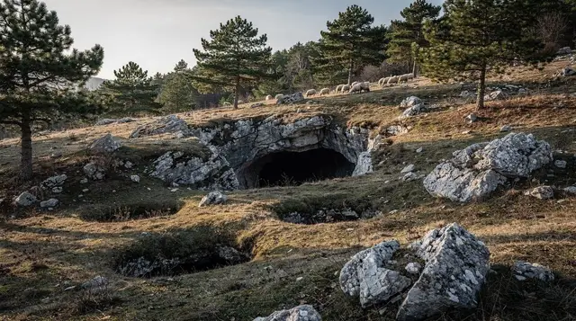
Arrive without expectations of a managed attraction and Igman works much better. There is no entrance gate, no café built around the jump towers and no rhythm of arriving coaches. The experience is quiet: wind in the grass, the outline of the towers against the sky, and a few other walkers or a passing 4x4. On a weekday outside the main season you may have the meadow almost to yourself, which is part of the appeal for people who find the old town busy.
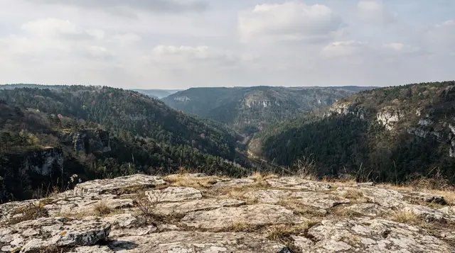
Pace the visit around the weather rather than around a checklist. Cloud can settle on the plateau while the valley below stays clear, and the reverse happens too. If the morning looks poor from the city, it is often worth waiting and going later, or switching the day to something in town such as the Sarajevo museums or a slower day in the city. A grey, windy plateau is still walkable, but the long views that make the trip worthwhile disappear.
Photographing the jump towers
The towers photograph best when you give them space. Walk a little way across the meadow rather than shooting from the car, so that the structures sit in the landscape instead of filling the frame. Low-angle light early or late in the day gives the concrete and steel more texture, while midday sun flattens them. Treat the structures as the ruins they are: do not climb on them and keep to the open ground around them, both for your own safety and because nobody maintains them any more.
If the Olympic story is what drew you here, it is worth reading ahead. The 1984 Olympics legacy guide and the Trebević bobsleigh guide explain what each venue was for, so the empty meadow reads as a place that once held a crowd rather than just a pretty field.
Choosing Igman against its neighbours
Igman sits in a cluster of mountain options, and it helps to know which one fits your day. Come here for the Olympic ruins and an easy, unhurried walk close to the city. Choose Trebević if you want the cable car and views over the city rooftops without driving. Choose Bjelašnica and Lukomir if you want wide highland scenery and a village that feels remote. Compare the two big ski mountains in Jahorina against Bjelašnica if winter is your reason for coming.
For a broader sense of how these outings fit together, hiking around Sarajevo and the best day trips from Sarajevo lay out the alternatives, and the guide on guided tours versus independent travel helps you decide whether to drive yourself or let someone else handle the road.
Practical habits for a day on the plateau
- Tell someone where you are going, particularly if you travel alone; see solo travel in Sarajevo for sensible habits.
- Download an offline map before you leave the city, since signal comes and goes.
- Bring food and water from Sarajevo or Ilidža, as the plateau offers little in the way of services.
- Carry a windproof layer even on a bright day, and sun protection in summer.
- Keep your phone charged and keep the car’s fuel topped up before heading up from the valley.
- Leave no rubbish behind; the meadow is used by grazing animals and by other walkers.
Families can treat the flat ground around Veliko Polje as an easy outing, with the usual caution about staying on the open tracks; family day trips from Sarajevo has more ideas for days that suit younger children.
When to go
Igman is walkable from spring through autumn, with May to June and September into early October giving the most comfortable temperatures on an exposed plateau. July and August are warm but rarely uncomfortable at this altitude, a genuine relief from the 30 to 35 degree heat that settles into the Sarajevo valley in high summer. Winter brings snow and closes off casual walking beyond the cleared road, though the plateau’s edges connect into the wider skiing area shared with Bjelašnica; see skiing near Sarajevo for where the lifts actually operate today, since Igman’s own Nordic infrastructure at Veliko Polje has not run commercially since the war.
A half-day plan
For a self-driven half-day: leave Sarajevo by mid-morning, reach Veliko Polje inside 40 minutes, spend an hour or two walking around the jump towers and out toward Mrazišta on the marked tracks, then either return to the city for the afternoon or continue over the saddle toward Bjelašnica if you have a full day and a suitable vehicle.
Combine it with a stop at Vrelo Bosne in Ilidža on the way out or back, since the source of the Bosna sits directly on the route between Sarajevo and Igman and adds very little driving time. For a wider view of what a longer stay in the mountains around Sarajevo can look like, the four-day Sarajevo itinerary sets Igman alongside Bjelašnica, Lukomir and a day in the city itself.
Igman rarely tops a first-time visitor’s list, and that is roughly right: it is not a single dramatic sight but a plateau that rewards a few unhurried hours, best understood alongside its neighbours rather than on its own. Go for the jump towers at Veliko Polje, the easy walking, and the road on to Bjelašnica and Lukomir; keep the wartime history in mind without treating the mountain as a site built to explain it; and stay on the marked paths throughout.
Mountain excursions on GetYourGuide
Verified deep-linked GetYourGuide tours. Book through these links and we earn a small commission at no cost to you.
GetYourGuide does not provide a product photo for this activity — the image shows the meeting point, photographed by us.